Parma
@parma26
- Joined
- Feb 12, 2014
- Messages
- 754
I always love it when I find a new trip report on here so I thought it's about time I contribute one. This is from a trip in late July 2013 to Fox Lake, it's in the eastern Uintas starting at the Westfork/Whiterocks Trailhead north of Roosevelt, Utah. Most mentions I see of Fox Lake are of people doing the Highline Trail. It's about 9 miles from the trailhead to Fox Lake and you get to go over the infamous Fox/Queant Pass. This pass is steep and all rocks.
This was a trip with me and another adult and 10 boy scouts. Don't worry, I won't be reviewing the scout stuff, just the trip and the scenery. But my son turned 12 a couple months before this and this was his first backpacking experience and I think he's hooked now!
Anyway, on with the show...
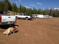
This is at the Westfork Trailhead. Notice the horse trailers. A portion of the trail is shared with horses and it SUCKS! It was extra muddy and very rough and torn up. This was Brian's dog Cody that was mentioned in my "Scariest Backcountry Story" thread: http://backcountrypost.com/forum/threads/scariest-backcountry-experiences.2619/#post-33154
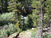
On the trail you hike near the Whiterocks River, and here it is.
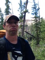
Here I am after realizing that hiking with some 12-13 year old boys takes forever!
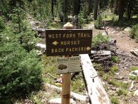
Finally the trail splits for horses and hikers...and watch for toads.
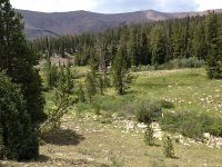
This was my first backpacking trip in the Uintas, and I love the high country. This is somewhere between the trailhead and Cleveland Lake.
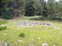
At one time, this was a small pond. I thought the rocks in the center were cool.
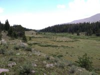
A panorama of one of the meadows

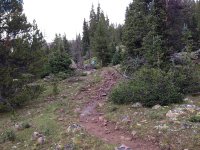
Here's what the trail looks like most of the way. Pretty good condition all the way. This was right after a brief storm, thus the mud.
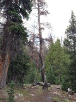
This was a very twisted tree I thought was photo worthy.
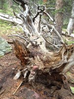
And not too far up the trail was this fallen tree with some rocks embedded into it.
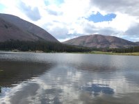
Here is Cleveland Lake. We ended up staying the night here. Some were taking a weee bit longer than we expected, so instead of hiking in the dark, we stopped here. It was about 4.5 miles to here.
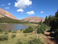
The next morning we headed for Fox Lake and that means it's time to cross the pass...cue the music. Fox Queant Pass is the saddle area above the lake in this photo. It was a little more than a mile away.
This is at the base of the pass looking up at it. Yes, there is a trail in there. I'd love to know the story on how they made the trail. It had to take a long time to move the rocks away to blaze it. I was thinking that it would have made a great project for some inmates. Tough labor but a great reward for good behavior.
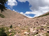
So I'm about to start up the pass and looking at the others going up, you can see a few rocks.
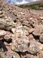
Here's what the trail looks like. This is looking back toward Cleveland Lake where we came.
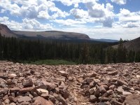
This is the unnamed pond going up the pass. This is at just over 11,000 feet.
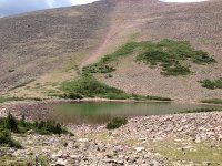
Looking down at the pond and the area below. As you can see, there are less rocks, but it got pretty steep here.
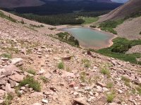
Crossing the boundary from the Vernal Ranger District to the Roosevelt District. The wooden sign ahead marks the top of the pass. This is at 11,400 feet.
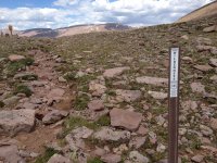
This is looking on the other side toward Fox Lake...finally headed down hill.
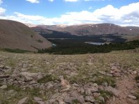
This is going down the other side. The map shows the trail going to the left, but it now goes to the right. I think the water rushing down the trail during/after storms caused the change.
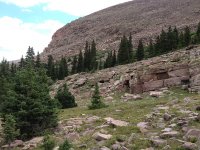
This is Crescent Lake, Crescent because it curves around the mountain and forms a crescent shape...see, you learn something everyday.
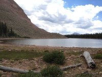
This is approaching Fox Lake. My friend with us said this area is usually covered with water. This is pretty low.
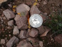
Finding one of these is always like finding an Easter Egg
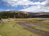
And here is Fox Lake. The structure you see on the left is a control housing for the stream/river that outlets to the other side.
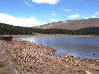
And now we meet up with the Highline Trail on the north side of Fox Lake.
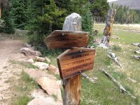
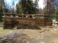
Here's an old cabin that we tell the kids is where the Sasquatch lives. They laugh, but keep an eye on it really wondering if it is indeed a joke.
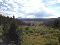
This is west of Fox Lake looking at the Painter and Gilbert Creek Basins with King's Peak in the background. The Kidney Lakes are somewhere out there.
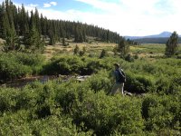
Here's Brian demonstrating the epic fly fishing in this area. I kid you not...the instant his fly touched the water on his first cast a Brook Trout bit. It was pretty fast and furious along these streams/small rivers in this area the whole time. Those little Brookies loved them a fly. I had two bit at my fly at the same time. The streams were loaded with small Brook Trout and the lakes had some larger ones and an occasional Cutthroat.
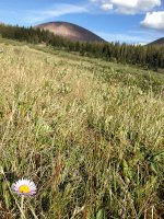
This is the obligatory flower photo
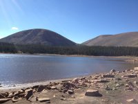
This is Fox Lake with North Pole Pass in the background
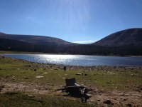
And looking to the other side you see Fox Queant Pass in the background.
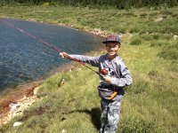
Proud papa moment time, this is my son catching his first fish.
After a night a Cleveland Lake and two nights at Fox Lake we headed back to Cleveland. And I love being in the thick wooded areas.
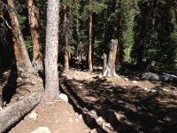
Headed back, and you gotta love the views when you are backpacking!
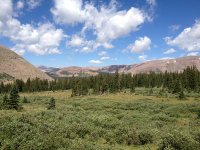
Starting the trek back over the pass
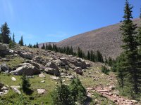
Guess where this is. And I show my pack because there is no better motivator to buy better gear than going on a trip with crap. This stupid pad I had wouldn't close. It would inflate and look nice and comfy. But the valve wouldn't close. It would deflate when you slept on it, and inflate when you rolled it and put it on your pack. So this pad has been replaced with a smaller, lighter, and more comfy pad after a trip to REI.
Now I need to work on not getting my finger in the photo!
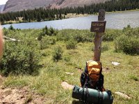
Here is Whiterocks River that drains from Cleveland Lake.
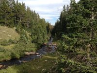
Someone built this little structure a while ago. It made for a good backpack storage while the scouts did their night in the woods alone for the Wilderness Survival merit badge. And naturally, that was the only night it rained and the lighting in the Uintas is intimidating to say the least. They survived, and it made for a more memorable night.
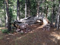
Back and headed home, this is the dirt road you take to the trailhead.
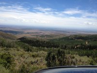
This is the real motivation hiking out after 5 days/4 nights in the mountains!

So there you have it, let me know what you think. It was a pretty fun trip, we logged about 20 miles over the entire trip and didn't really come across too many people.
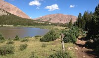
Featured image for home page:
This was a trip with me and another adult and 10 boy scouts. Don't worry, I won't be reviewing the scout stuff, just the trip and the scenery. But my son turned 12 a couple months before this and this was his first backpacking experience and I think he's hooked now!
Anyway, on with the show...
This is at the Westfork Trailhead. Notice the horse trailers. A portion of the trail is shared with horses and it SUCKS! It was extra muddy and very rough and torn up. This was Brian's dog Cody that was mentioned in my "Scariest Backcountry Story" thread: http://backcountrypost.com/forum/threads/scariest-backcountry-experiences.2619/#post-33154

On the trail you hike near the Whiterocks River, and here it is.

Here I am after realizing that hiking with some 12-13 year old boys takes forever!

Finally the trail splits for horses and hikers...and watch for toads.

This was my first backpacking trip in the Uintas, and I love the high country. This is somewhere between the trailhead and Cleveland Lake.

At one time, this was a small pond. I thought the rocks in the center were cool.

A panorama of one of the meadows


Here's what the trail looks like most of the way. Pretty good condition all the way. This was right after a brief storm, thus the mud.

This was a very twisted tree I thought was photo worthy.

And not too far up the trail was this fallen tree with some rocks embedded into it.

Here is Cleveland Lake. We ended up staying the night here. Some were taking a weee bit longer than we expected, so instead of hiking in the dark, we stopped here. It was about 4.5 miles to here.

The next morning we headed for Fox Lake and that means it's time to cross the pass...cue the music. Fox Queant Pass is the saddle area above the lake in this photo. It was a little more than a mile away.

This is at the base of the pass looking up at it. Yes, there is a trail in there. I'd love to know the story on how they made the trail. It had to take a long time to move the rocks away to blaze it. I was thinking that it would have made a great project for some inmates. Tough labor but a great reward for good behavior.

So I'm about to start up the pass and looking at the others going up, you can see a few rocks.

Here's what the trail looks like. This is looking back toward Cleveland Lake where we came.

This is the unnamed pond going up the pass. This is at just over 11,000 feet.

Looking down at the pond and the area below. As you can see, there are less rocks, but it got pretty steep here.

Crossing the boundary from the Vernal Ranger District to the Roosevelt District. The wooden sign ahead marks the top of the pass. This is at 11,400 feet.

This is looking on the other side toward Fox Lake...finally headed down hill.

This is going down the other side. The map shows the trail going to the left, but it now goes to the right. I think the water rushing down the trail during/after storms caused the change.

This is Crescent Lake, Crescent because it curves around the mountain and forms a crescent shape...see, you learn something everyday.

This is approaching Fox Lake. My friend with us said this area is usually covered with water. This is pretty low.

Finding one of these is always like finding an Easter Egg

And here is Fox Lake. The structure you see on the left is a control housing for the stream/river that outlets to the other side.

And now we meet up with the Highline Trail on the north side of Fox Lake.

Here's an old cabin that we tell the kids is where the Sasquatch lives. They laugh, but keep an eye on it really wondering if it is indeed a joke.

This is west of Fox Lake looking at the Painter and Gilbert Creek Basins with King's Peak in the background. The Kidney Lakes are somewhere out there.

Here's Brian demonstrating the epic fly fishing in this area. I kid you not...the instant his fly touched the water on his first cast a Brook Trout bit. It was pretty fast and furious along these streams/small rivers in this area the whole time. Those little Brookies loved them a fly. I had two bit at my fly at the same time. The streams were loaded with small Brook Trout and the lakes had some larger ones and an occasional Cutthroat.

This is the obligatory flower photo

This is Fox Lake with North Pole Pass in the background

And looking to the other side you see Fox Queant Pass in the background.

Proud papa moment time, this is my son catching his first fish.

After a night a Cleveland Lake and two nights at Fox Lake we headed back to Cleveland. And I love being in the thick wooded areas.

Headed back, and you gotta love the views when you are backpacking!

Starting the trek back over the pass

Guess where this is. And I show my pack because there is no better motivator to buy better gear than going on a trip with crap. This stupid pad I had wouldn't close. It would inflate and look nice and comfy. But the valve wouldn't close. It would deflate when you slept on it, and inflate when you rolled it and put it on your pack. So this pad has been replaced with a smaller, lighter, and more comfy pad after a trip to REI.
Now I need to work on not getting my finger in the photo!

Here is Whiterocks River that drains from Cleveland Lake.

Someone built this little structure a while ago. It made for a good backpack storage while the scouts did their night in the woods alone for the Wilderness Survival merit badge. And naturally, that was the only night it rained and the lighting in the Uintas is intimidating to say the least. They survived, and it made for a more memorable night.

Back and headed home, this is the dirt road you take to the trailhead.

This is the real motivation hiking out after 5 days/4 nights in the mountains!

So there you have it, let me know what you think. It was a pretty fun trip, we logged about 20 miles over the entire trip and didn't really come across too many people.
Featured image for home page:

Last edited:
