hatchcanyon
Member
- Joined
- May 29, 2013
- Messages
- 136
This is more or less the third part of the "Avoiding Thunderstorms" story but this part can stand alone too.
A little bit more than 4 Miles west of our lunch place we turned left (South) on a very good dirt road. The first miles were not that impressive. Pinion and Juniper as usual, no cliffs. The sky still overcast, therefore not the best light for photography.
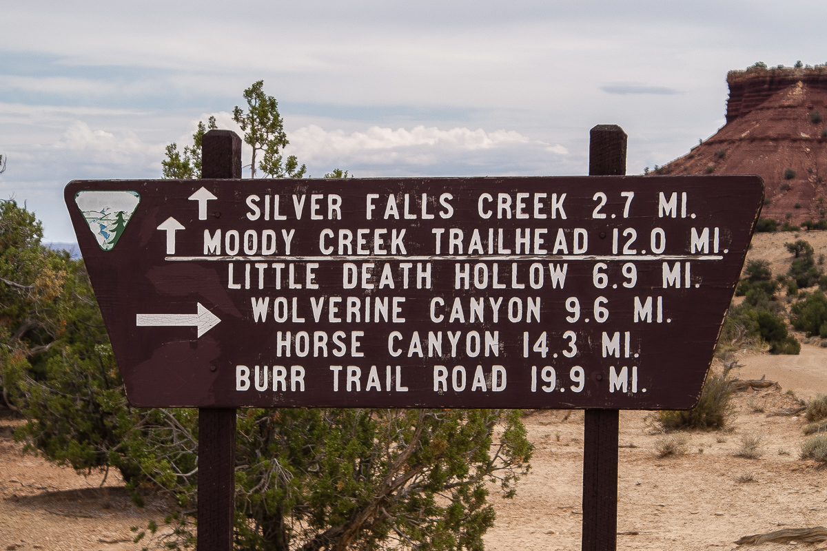
There is a road fork 10 Miles south of Burr trail.
We kept straight on to Silver Falls Creek but did not go into the canyon. We decided to travel farther to the South into the Moody Creek system. Half an hour later and with another thunderstorm approaching from the West wer reached the wash of Moody Creek. For us it was the Creek of Hollow Stones. See the pictures below:

A new thunderstorm builds up in the West.

Moody Creek Wash


We thought the trail might not have used for a longer time. We couldn't find any tracks.

After two Miles the trail leaves Moody Creek goint East. The start point for the Purple Hills.
A little bit more than 4 Miles west of our lunch place we turned left (South) on a very good dirt road. The first miles were not that impressive. Pinion and Juniper as usual, no cliffs. The sky still overcast, therefore not the best light for photography.
There is a road fork 10 Miles south of Burr trail.
We kept straight on to Silver Falls Creek but did not go into the canyon. We decided to travel farther to the South into the Moody Creek system. Half an hour later and with another thunderstorm approaching from the West wer reached the wash of Moody Creek. For us it was the Creek of Hollow Stones. See the pictures below:
A new thunderstorm builds up in the West.
Moody Creek Wash
We thought the trail might not have used for a longer time. We couldn't find any tracks.
After two Miles the trail leaves Moody Creek goint East. The start point for the Purple Hills.