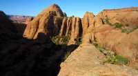
lostlandscapes
rope mule
- Joined
- Jan 17, 2012
- Messages
- 328
drclef and I took advantage of this lingering balmy autumn of ours and visited the Moab area this past weekend for a couple of canyons. On Saturday we hit Rock of Ages, a fun and absolutely beautiful mid-sized romp in the Pritchett Canyon area.
[parsehtml]
<iframe width="850" height="500" frameborder="0" scrolling="no"
marginheight="0" marginwidth="0"
src="https://maps.google.com/maps/ms?hl=...n=0.016785,0.036478&z=15&output=embed"></iframe><br
/><small>View <a
href="https://maps.google.com/maps/ms?hl=...n=0.016785,0.036478&z=15&source=embed"
style="text-align:left">Rock of Ages</a> in a larger
map</small><br><br>
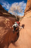
[/parsehtml]Mandy putting the ankle brace to the test:
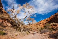
It was refreshing to see some foliage (and even a little color) clinging to the cottonwoods:
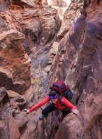
One of the elements that makes Rock of Ages so enjoyable is the initial upclimb. Here's Mandy at the crux of the first crack:
A gorgeous day in Moab:
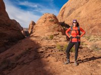
A bit of flat sandstone in between the two crack climbs:
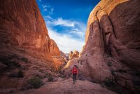
Approaching the second squeeze:
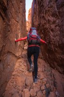
The view of the fin country is startling from the top:
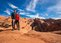
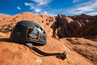
Not to be outdone, BCP gets into the mix:
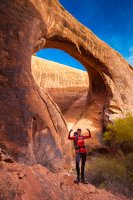
Pool Arch, just under the start of the descent:
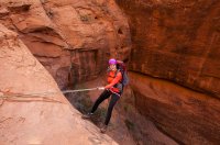
Mandy on the first rap, a 50 footer down a clean, vertical wall:
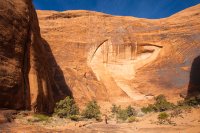
The canyon doing it's best Escalante impression in between the two raps:
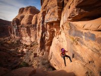
Mandy taking the first step down the second (and final) 100' rap which ends free and places you into a lovely grotto, which come summertime is bustling with the antithetical floral companionship of blooming columbines and poison ivy. *Fair warning*: This is one seriously sketchy anchor to get out to. Protection for whomever rigs the rappel is mandatory. There exists one single bolt higher up (which a lot of people still rap from: take note of the rope grooves) which Mandy belayed me down from so I could get out to set up the rap. It's not only airy, but the downward sloping nature of the lower platform slopes down towards the drop. One wrong move and you're gone. Questionable bolt placement, to say the least. A permanent hand-line (a la Mystery Springs) between the two bolt stations wouldn't be the worst idea in the world.
The canyon can hold a bit of water, but thankfully for us it was only shin deep. Car to car we were just over 5 hours. Rock of Ages definitely deserves it's status as one of Moab's classics, and serves as a perfect winter antidote for other fellow restless canyoneers out there.
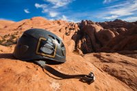
Featured image for home page:
[parsehtml]
<iframe width="850" height="500" frameborder="0" scrolling="no"
marginheight="0" marginwidth="0"
src="https://maps.google.com/maps/ms?hl=...n=0.016785,0.036478&z=15&output=embed"></iframe><br
/><small>View <a
href="https://maps.google.com/maps/ms?hl=...n=0.016785,0.036478&z=15&source=embed"
style="text-align:left">Rock of Ages</a> in a larger
map</small><br><br>
[/parsehtml]Mandy putting the ankle brace to the test:

It was refreshing to see some foliage (and even a little color) clinging to the cottonwoods:

One of the elements that makes Rock of Ages so enjoyable is the initial upclimb. Here's Mandy at the crux of the first crack:

A gorgeous day in Moab:

A bit of flat sandstone in between the two crack climbs:

Approaching the second squeeze:

The view of the fin country is startling from the top:

Not to be outdone, BCP gets into the mix:

Pool Arch, just under the start of the descent:

Mandy on the first rap, a 50 footer down a clean, vertical wall:

The canyon doing it's best Escalante impression in between the two raps:

Mandy taking the first step down the second (and final) 100' rap which ends free and places you into a lovely grotto, which come summertime is bustling with the antithetical floral companionship of blooming columbines and poison ivy. *Fair warning*: This is one seriously sketchy anchor to get out to. Protection for whomever rigs the rappel is mandatory. There exists one single bolt higher up (which a lot of people still rap from: take note of the rope grooves) which Mandy belayed me down from so I could get out to set up the rap. It's not only airy, but the downward sloping nature of the lower platform slopes down towards the drop. One wrong move and you're gone. Questionable bolt placement, to say the least. A permanent hand-line (a la Mystery Springs) between the two bolt stations wouldn't be the worst idea in the world.

The canyon can hold a bit of water, but thankfully for us it was only shin deep. Car to car we were just over 5 hours. Rock of Ages definitely deserves it's status as one of Moab's classics, and serves as a perfect winter antidote for other fellow restless canyoneers out there.
Featured image for home page:


