- Joined
- Dec 2, 2019
- Messages
- 142
This was definitely a really fun day-hike in a little-visited area of Zion National Park.
Most visitors will be familiar with the incredibly scenic drive through the eastern section of the park, if they arrive from Kanab or Bryce. Except for the East Rim Trail, which wends its way towards Observation Point, there are few maintained trails in the Upper East area of Zion. However, from the roadside pull-outs there are wonderful opportunities to explore the colorful slickrock surrounds; the most popular of which is the 'Many Pools' route. Joe Braun's superb website details a myriad of hiking opportunities throughout the park, with several routes in this eastern section.
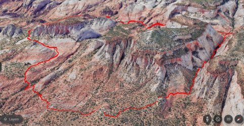
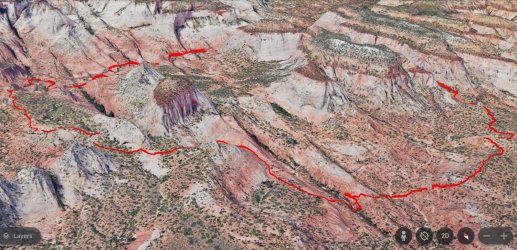
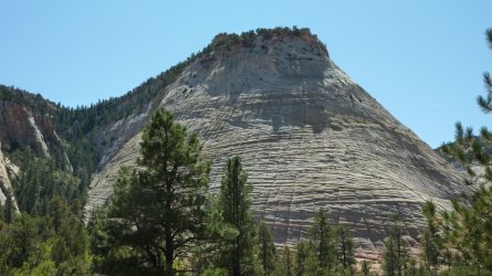
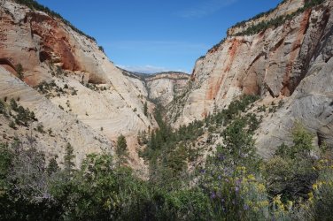
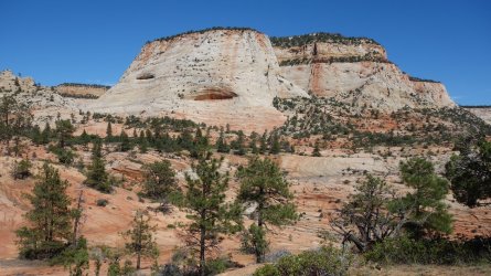
The hike I did starts close to the large parking area used as the main viewpoint for one of the park's iconic features: Checkerboard Mesa. The route follows the narrow drainage west of the mesa, between it and the wonderfully named Crazy Quilt Mesa. It is a relatively straightforward uphill walk, mainly along a brushy sandy wash, with the occasional clamber up slippy, sandy slopes covered in vegetation. A little bushwhacking is required close to the saddle at the top, but nothing to deter the determined hiker.
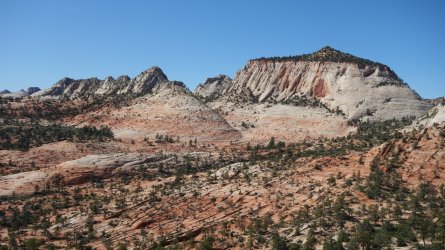
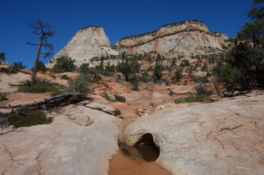
Once over the saddle, a short sandy slope leads downhill into a wide sandstone basin, after which one can then spend hours exploring the magnificent surrounding slickrock wonderland that seems to stretch for miles. The hiking in this area is generally easy, but occasionally an unexpected gully or steep slope will be encountered, that requires a little backcountry problem-solving in order to proceed. In addition to the pink and white sandstone features, there are many lovely ponderosa pine oases, with an occasional water-filled pothole. The views throughout are, needless to say, fantastic, and, with little likelihood of meeting another person here, the opportunities for solitude abound.
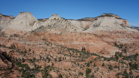
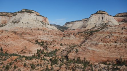
I didn't really have a set route in mind, but after wandering westwards for a while, I spotted a wide gap between two small mesas to the north. After negotiating my way through there, I then headed out towards the end of a promontory to hopefully access a good view of the high mesas which cover much of the Upper East portion of Zion. The views were magnificent, and I was able to look down on the highway snaking through the park towards the east entrance.
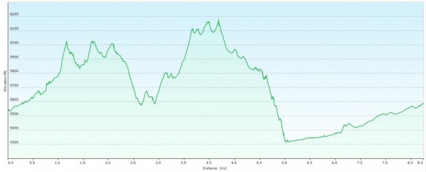
I had walked quite a distance now, and the sensible option would have been to backtrack my route thus far. However, since I was now just half a mile from the road, I decided to take the direct route, straight down the hill. It wasn't exactly straightforward and it took me a nerve-shredding 45 minutes to descend the steep 500 feet, but I made it in the end.
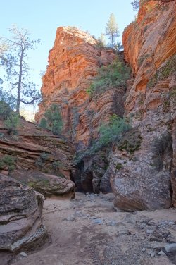
I then followed the Clear Creek drainage, which runs alongside and below the road, although this ended up being a little tedious because it isn't really possible to see much of the surrounding stunning sandstone formations. I completed the last couple of miles of the route walking eastwards along the road, which provided much better views, and allowed me to complete a very enjoyable loop-hike.
.Most visitors will be familiar with the incredibly scenic drive through the eastern section of the park, if they arrive from Kanab or Bryce. Except for the East Rim Trail, which wends its way towards Observation Point, there are few maintained trails in the Upper East area of Zion. However, from the roadside pull-outs there are wonderful opportunities to explore the colorful slickrock surrounds; the most popular of which is the 'Many Pools' route. Joe Braun's superb website details a myriad of hiking opportunities throughout the park, with several routes in this eastern section.
The hike I did starts close to the large parking area used as the main viewpoint for one of the park's iconic features: Checkerboard Mesa. The route follows the narrow drainage west of the mesa, between it and the wonderfully named Crazy Quilt Mesa. It is a relatively straightforward uphill walk, mainly along a brushy sandy wash, with the occasional clamber up slippy, sandy slopes covered in vegetation. A little bushwhacking is required close to the saddle at the top, but nothing to deter the determined hiker.
Once over the saddle, a short sandy slope leads downhill into a wide sandstone basin, after which one can then spend hours exploring the magnificent surrounding slickrock wonderland that seems to stretch for miles. The hiking in this area is generally easy, but occasionally an unexpected gully or steep slope will be encountered, that requires a little backcountry problem-solving in order to proceed. In addition to the pink and white sandstone features, there are many lovely ponderosa pine oases, with an occasional water-filled pothole. The views throughout are, needless to say, fantastic, and, with little likelihood of meeting another person here, the opportunities for solitude abound.
I didn't really have a set route in mind, but after wandering westwards for a while, I spotted a wide gap between two small mesas to the north. After negotiating my way through there, I then headed out towards the end of a promontory to hopefully access a good view of the high mesas which cover much of the Upper East portion of Zion. The views were magnificent, and I was able to look down on the highway snaking through the park towards the east entrance.
I had walked quite a distance now, and the sensible option would have been to backtrack my route thus far. However, since I was now just half a mile from the road, I decided to take the direct route, straight down the hill. It wasn't exactly straightforward and it took me a nerve-shredding 45 minutes to descend the steep 500 feet, but I made it in the end.
I then followed the Clear Creek drainage, which runs alongside and below the road, although this ended up being a little tedious because it isn't really possible to see much of the surrounding stunning sandstone formations. I completed the last couple of miles of the route walking eastwards along the road, which provided much better views, and allowed me to complete a very enjoyable loop-hike.
Google Earth 3D view looking north-west
.
.
Google Earth 3D view looking north-east
.
.
Elevation Profile
.
.
Checkerboard Mesa - the route is to the right of the mesa
.
.
Emerging from the narrow route between Checkerboard Mesa and Crazy Quilt Mesa
.
.
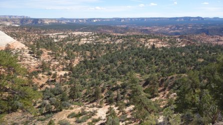
Looking south-east towards Poverty Flat, The Barracks, Harris Flat, and the Moquith Mountains
.
.
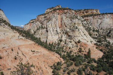
Looking back towards the back of Checkerboard Mesa
.
.
Slickrock wonderland
.
.
Desert water
.
.
Crazy Quilt Mesa and Checkerboard Mesa
.
.
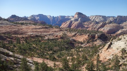
Looking west, towards the Main Canyon and The East Temple
.
.
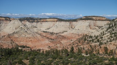
View of the East Rim
.
.
Highway 9 snaking through the park
.
.
Highway 9 heads towards the East entrance of the park
.
.
Clear Creek drainage
......................
 ..........
Last edited:
