- Joined
- Aug 8, 2016
- Messages
- 2,072
I've had a rather modest bucket list of peaks I wanted to summit this year. One of those is Deseret Peak in the Stansbury Mountains in Tooele County, Utah. I had never been out in the Stansburys before and didn't know what to expect. I was so surprised at the incredible beauty of this small mountain range.
Here's a video if you like. It's my first one done in 4K hope you like it.
If a video is not to your liking read on...
I began the adventure heading up South Willow Canyon a few miles south of Grantsville. Just before turning west on South Willow Canyon road I noticed a beautiful, pre-dawn view to the east featuring Tooele City below the Oquirrh Mountains...
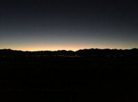
... and the mountain tops of the Stansburys including my goal for the day, Deseret Peak. (sorry about the grainy photo, that's about the best a smart phone can do with low light I think)...
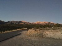
The trail starts from the Loop Campground at the end of South Willow Canyon Road. Heading mostly west up Mill Hollow the trail quickly crosses the Deseret Peak Wilderness boundary. At about 0.6 miles the trail crosses the mostly dry creek bed to the south where you immediately come the the junction of several trails. My route to Deseret Peak would take me due south up South Willow Creek. The dawning sun provided views of the mountain peaks that were stunning...
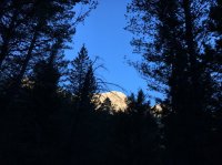
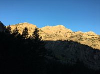
The trail up South Willow Creek is a moderate climb with several sets of very efficient switchbacks making the climb to the saddle at 10,200 ft not overly taxing. The views began to get better and better as I climbed up toward the saddle. My first good view of the Great Salt Lake and environs...
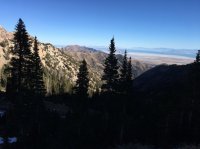
Once you reach the saddle you arrive at the junction with the Bear Fork and Stansbury Crest Trails. The route to the summit is west on the Stansbury Crest trail where you can see the east face of ridge connecting with Deseret Peak...
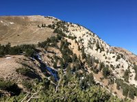
The trail now gets a bit steeper and with the increased altitude becomes a bit more of a grunt. The trail heads southwest then around the back side of the peak. The peak sits at 11,033 ft, just about a mile from the saddle. The views from the peak are incredible!
The Great Salt Lake with the Wasatch Mountains in the background...
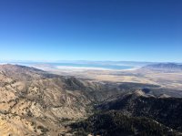
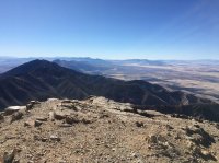
Looking north along the spine of the Stansburys...
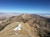
ESE with Mt Nebo in the distance...
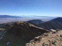
Looking due south...
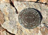
The official marker...
Looking over a nice windbreak wall at the West Desert...
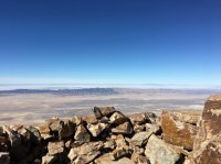
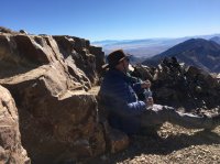
A great spot for some lunch with a view...
The trail would continue along the ridge line to the north. If you look closely you can see the trail heading up the next mountain in a sparsely-treed area the distance...
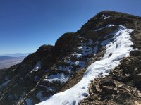
Looking back at the peak...
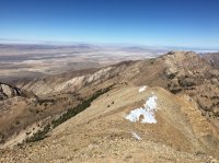
The top of a bunch of switchbacks that take you down the west and north side of the mountain. The trail would shortly become very narrow across the steep north side slope...
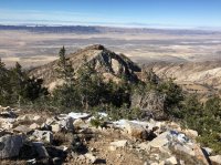
Another look back at the peak at the bottom of the switch backs...
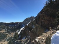
And again a little further down...
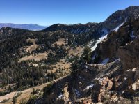
Just below the saddle which would take me down Pockets Fork you can see from where I came. Deseret Peak is the high point. The snowy area just to the right and below the prominent peak on the right is where the switchbacks bring you down, crossing the chute running down from the left of the same peak, continuing down to the saddle below. The trail then continues to drop down almost to the head of the canyon then climbs back up to this point. It was quite a ride...
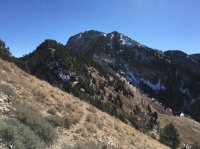
A rugged old tree still hanging in there just below the saddle over Pockets Fork...
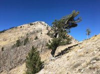
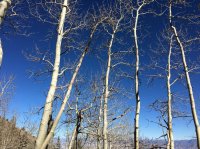
The trail now heads down Pockets Fork. Still fairly steep with quite a bit of icy snow in the upper part of the draw was beginning to take its toll on the old knees. The incredible views at every turn made the discomfort tolerable in any event. I took one last rest break just before the trail joins up with the Dry Lake fork. I couldn't help being amazed at how blue the sky had been all day...
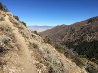
The trail down Dry Fork which would shortly join back up with the main trail back to the truck...
I arrived back at the trail head where GPS reported 12.1 miles. This is definitely one of my favorite hikes I've ever done. It's a great day hike that I'll have to do again next year. I highly recommend it!
Here's a video if you like. It's my first one done in 4K hope you like it.
If a video is not to your liking read on...
I began the adventure heading up South Willow Canyon a few miles south of Grantsville. Just before turning west on South Willow Canyon road I noticed a beautiful, pre-dawn view to the east featuring Tooele City below the Oquirrh Mountains...

... and the mountain tops of the Stansburys including my goal for the day, Deseret Peak. (sorry about the grainy photo, that's about the best a smart phone can do with low light I think)...

The trail starts from the Loop Campground at the end of South Willow Canyon Road. Heading mostly west up Mill Hollow the trail quickly crosses the Deseret Peak Wilderness boundary. At about 0.6 miles the trail crosses the mostly dry creek bed to the south where you immediately come the the junction of several trails. My route to Deseret Peak would take me due south up South Willow Creek. The dawning sun provided views of the mountain peaks that were stunning...


The trail up South Willow Creek is a moderate climb with several sets of very efficient switchbacks making the climb to the saddle at 10,200 ft not overly taxing. The views began to get better and better as I climbed up toward the saddle. My first good view of the Great Salt Lake and environs...

Once you reach the saddle you arrive at the junction with the Bear Fork and Stansbury Crest Trails. The route to the summit is west on the Stansbury Crest trail where you can see the east face of ridge connecting with Deseret Peak...

The trail now gets a bit steeper and with the increased altitude becomes a bit more of a grunt. The trail heads southwest then around the back side of the peak. The peak sits at 11,033 ft, just about a mile from the saddle. The views from the peak are incredible!
The Great Salt Lake with the Wasatch Mountains in the background...

Looking north along the spine of the Stansburys...

ESE with Mt Nebo in the distance...

Looking due south...

The official marker...

Looking over a nice windbreak wall at the West Desert...

A great spot for some lunch with a view...

The trail would continue along the ridge line to the north. If you look closely you can see the trail heading up the next mountain in a sparsely-treed area the distance...

Looking back at the peak...

The top of a bunch of switchbacks that take you down the west and north side of the mountain. The trail would shortly become very narrow across the steep north side slope...

Another look back at the peak at the bottom of the switch backs...

And again a little further down...

Just below the saddle which would take me down Pockets Fork you can see from where I came. Deseret Peak is the high point. The snowy area just to the right and below the prominent peak on the right is where the switchbacks bring you down, crossing the chute running down from the left of the same peak, continuing down to the saddle below. The trail then continues to drop down almost to the head of the canyon then climbs back up to this point. It was quite a ride...

A rugged old tree still hanging in there just below the saddle over Pockets Fork...

The trail now heads down Pockets Fork. Still fairly steep with quite a bit of icy snow in the upper part of the draw was beginning to take its toll on the old knees. The incredible views at every turn made the discomfort tolerable in any event. I took one last rest break just before the trail joins up with the Dry Lake fork. I couldn't help being amazed at how blue the sky had been all day...

The trail down Dry Fork which would shortly join back up with the main trail back to the truck...

I arrived back at the trail head where GPS reported 12.1 miles. This is definitely one of my favorite hikes I've ever done. It's a great day hike that I'll have to do again next year. I highly recommend it!
Last edited:
