Jimmy
Member
- Joined
- Oct 7, 2014
- Messages
- 98
My wife and I did a four day trip to Olympic in late May. This is a new area of the country for me - and her first time backpacking. After a week there, I look forward to exploring much more of the Pacific NW. It's an incredible, unique landscape, and the Olympic coast and rain forest are like no other areas I've explored. Since the alpine areas were well-snowed in, we decided to do the hike to Enchanted Valley in the Quinault rain forest area. This consists of 15 miles of skirting the Quinault river and adjacent creeks, ending in the picturesque / posctcard-perfect Enchanted Valley.
Day 1: After staying up way too late to see a concert in Seattle, we headed out early to Port Angeles to pick up our permit and stopped off at Lake Crescent and a few other spots along the way. Our plan was to camp near Hole in the Wall on the coast, but the tides and weather weren't agreeable, so we made that a quick day hike and headed down to Quinault and camped at Three Rivers campground. This is a utilitarian campground in the middle of the rain forest. It was fine for an evening, but nothing too exciting - LOTS of huckleberries around and an equal amount of bear scat.
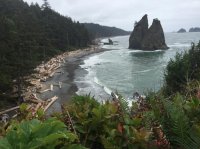
Hole in the Wall area:

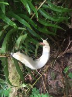
These huge albino slugs were everywhere in the Three Rivers campground.
Day 2: Got up early and headed to the Graves Creek Road. Due to a washout, you have to road hike approximately 2 miles (more like 2.4) to the Graves Creek trail head. From there, it's 13.2 miles to the entrance of the Enchanted Valley, and another mile or so to the heart of the Valley. We decided to make it to the Valley in one day, though the rangers advised us that the trail was washed out completely for a 1/2 mile section, as well as 100+ blow downs on the trail. We were trekking along well until we hit O' Neill Creek about 8 miles in, where the trail just...disappeared. We had heard to just follow the river, which was made complicated by the sheer size and volume of trees lining it. From the washout and continuing several miles, it was more like bouldering since we were climbing over large, downed trees. It made for a grueling day - one of the hardest days backpacking I've every done.
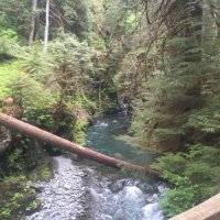
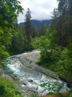
This was what the trail looked like for some time:
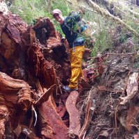
Yes, we have to cross over this...
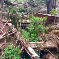
The downed trees, however, made convenient bridges in several spots:
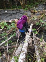
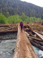
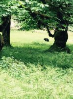
Given that bear scat was everywhere, we anticipated seeing more bears, but alas, we only stumbled upon this lonesome guy who barely noticed our existence.
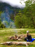
After 5ish miles of trail finding, tree crossing, creek fording fun, we FINALLY made it to the Enchanted Valley, and the trek in definitely became worthwhile! There was only one other camper in the very large valley, and we actually only saw his head and smoke from his fire. It felt like we had the entire place to ourselves.
Approaching the valley:
My wife is setting up a primo campsite:
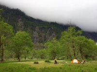
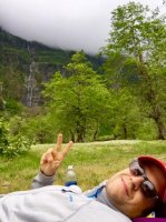
TONS of waterfalls all around us.
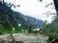
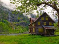
The abandoned chalet, built in the 1930s. The park service moved this last year to prevent it from falling into the encroaching river. I cannot fathom getting mule trains back to build this place like the original owner did.
Hobbit land?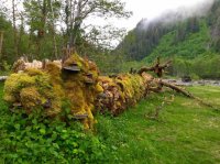
Day 3: Our plan was to day hike up towards Anderson pass from the Valley and then head back and camp there. However, about 4 miles up the trail to Anderson Pass (which was under multiple feet of snow), the blowdowns covered the trail again for the foreseeable miles ahead. We were DONE with scrambling over trees, so we decided to break camp and get a start on the way back since it took us a lot longer to make the trek in. We started out at about noon from the Valley back toward the TH. The photos trail off due to a heavy rainstorm that kept us focused on getting to our destination. In fact, due to the persistent rain storm - and due to the fact that we were better prepared for the maneuvering through the trees on the return - we made it all the way back to our car and drove to a little campground right on Lake Quinault for the final night. The warm beers in our car were welcome!
Further down the valley, heading toward Anderson Pass:
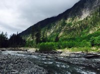
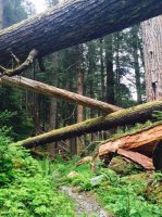
Downed trees or an art project?
The skies finally cleared as we set up camp near Lake Quinault that night.

Day 1: After staying up way too late to see a concert in Seattle, we headed out early to Port Angeles to pick up our permit and stopped off at Lake Crescent and a few other spots along the way. Our plan was to camp near Hole in the Wall on the coast, but the tides and weather weren't agreeable, so we made that a quick day hike and headed down to Quinault and camped at Three Rivers campground. This is a utilitarian campground in the middle of the rain forest. It was fine for an evening, but nothing too exciting - LOTS of huckleberries around and an equal amount of bear scat.
Hole in the Wall area:


These huge albino slugs were everywhere in the Three Rivers campground.

Day 2: Got up early and headed to the Graves Creek Road. Due to a washout, you have to road hike approximately 2 miles (more like 2.4) to the Graves Creek trail head. From there, it's 13.2 miles to the entrance of the Enchanted Valley, and another mile or so to the heart of the Valley. We decided to make it to the Valley in one day, though the rangers advised us that the trail was washed out completely for a 1/2 mile section, as well as 100+ blow downs on the trail. We were trekking along well until we hit O' Neill Creek about 8 miles in, where the trail just...disappeared. We had heard to just follow the river, which was made complicated by the sheer size and volume of trees lining it. From the washout and continuing several miles, it was more like bouldering since we were climbing over large, downed trees. It made for a grueling day - one of the hardest days backpacking I've every done.


This was what the trail looked like for some time:

Yes, we have to cross over this...

The downed trees, however, made convenient bridges in several spots:


Given that bear scat was everywhere, we anticipated seeing more bears, but alas, we only stumbled upon this lonesome guy who barely noticed our existence.

After 5ish miles of trail finding, tree crossing, creek fording fun, we FINALLY made it to the Enchanted Valley, and the trek in definitely became worthwhile! There was only one other camper in the very large valley, and we actually only saw his head and smoke from his fire. It felt like we had the entire place to ourselves.
Approaching the valley:

My wife is setting up a primo campsite:

TONS of waterfalls all around us.


The abandoned chalet, built in the 1930s. The park service moved this last year to prevent it from falling into the encroaching river. I cannot fathom getting mule trains back to build this place like the original owner did.

Hobbit land?

Day 3: Our plan was to day hike up towards Anderson pass from the Valley and then head back and camp there. However, about 4 miles up the trail to Anderson Pass (which was under multiple feet of snow), the blowdowns covered the trail again for the foreseeable miles ahead. We were DONE with scrambling over trees, so we decided to break camp and get a start on the way back since it took us a lot longer to make the trek in. We started out at about noon from the Valley back toward the TH. The photos trail off due to a heavy rainstorm that kept us focused on getting to our destination. In fact, due to the persistent rain storm - and due to the fact that we were better prepared for the maneuvering through the trees on the return - we made it all the way back to our car and drove to a little campground right on Lake Quinault for the final night. The warm beers in our car were welcome!
Further down the valley, heading toward Anderson Pass:

Downed trees or an art project?

The skies finally cleared as we set up camp near Lake Quinault that night.

