SKLund
Member
- Joined
- Aug 19, 2016
- Messages
- 459
Note: Photos were taken with a point and shoot and down sized for posting. Not the greatest I know.
I casually asked were he was going next. “Sierra Negra”, he said. My response was instant. I wanted to go and said so. His answer? No. “It’s too hard and there is a lot of route finding”. The die was cast, the gauntlet thrown. I had to do Sierra Negra and I had to do it solo...the way he did it. Why? Because I was temporarily testosterone poisoned? Yes but not when I started to look at the problem. That's when a desire set in. Sierra Negra sits on the very edge of the Colorado Plateau near Abiquiu, New Mexico. You pass through the vestiges of the White Place, also known as Plaza Blanca. This is Georgia O’Keefe country. She painted these iconic landscapes. The red rock of the Plateau is literally a mile away. Cerro Pedernal, always in view, on the horizon.
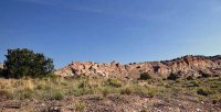
Head out of the wash and start up the mesa here.
Time passed. A cursory look at the map was intimidating. The slopes of this peak are over twenty five percent on all sides but one. The North slope (ironically) is under twenty percent but has a long run out, over six miles, before the climb starts. Now add the route finding. The friendliest side of the peak is convoluted, passing through a province of slots and mesas with attendant cliff outs and pour offs. It took a trip to the field to test and work through the approach. Just the approach.
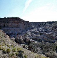
From mesa top. There is supposed to be a route through that canyon. Couldn't find it.
An unseasonably cool week in August gave me my chance. Normally I would never attempt a peak like this any earlier than Fall, but going solo, I needed all the daylight I could get. This was a perfect opportunity.
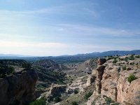
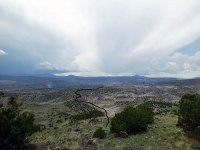
Could have come up to the mesa that way also. Maybe next time. Green strip is the Chama River.
I lead trips. I take people out and guide them to cool places and when I do, I have it totally wired. The gear list is inventoried and checked down to every bandage. This time, going solo, I was feeling kind of loose in that, I can handle it, leave the brain at home kind of way. First I left the food at home. Yeah a twenty nine hundred foot, twelve mile hike with just the power bar already in the pack, but the coup de grace was parking my truck in a flood plain during monsoon season. Brilliant.
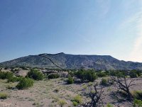
Once you are up and over the mesa, you get first clear view of the mountain. The line is a very rough outline of my route. You don't traverse the summit ridge as the line indicates. You go around the ridge and up instead.
The hike and climb itself was fabulous in that simple, fully absorbed in the task way, that leaves the world and its cares elsewhere. Weaving a line through way points, I keep to the shallowest of slope angles. Care is required here. You have to pick your way over and through volcanic boulders and tangles of dead trees. Gaining the summit was anticlimactic. The views as expected but now they were rapidly being obscured by thunderheads. Time to go.
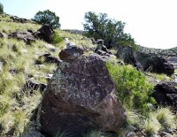
Someone else has been this way...
The climb down. The jaw tightens. Got to go slow and careful. No face plants allowed. I’m hungry now. Those clouds are getting close. I still have to get up and over the mesa and weave my way through those canyons back to the truck. The one sitting in a flood plain, with storm clouds on the way. I tend to get lost when I get tired and hungry. Now stumbling and worried, I am getting cliffed and chock stoned. Back tracking, panic starting to set in with visions of my truck tumbling through a flash flood. Finally staying above the slots and working my down, I find a way to butt slide into the wash. You know the next part: the exhaustion sets in when the difficult part is over.
The down route back and up and over the mesa and down again.
Finally the truck, Gatorade (two bottles), red chile burrito, wife, world. And the creeping desire to go back to Sierra Negra.
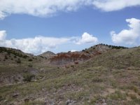
At the bottom between peak and mesa.
I casually asked were he was going next. “Sierra Negra”, he said. My response was instant. I wanted to go and said so. His answer? No. “It’s too hard and there is a lot of route finding”. The die was cast, the gauntlet thrown. I had to do Sierra Negra and I had to do it solo...the way he did it. Why? Because I was temporarily testosterone poisoned? Yes but not when I started to look at the problem. That's when a desire set in. Sierra Negra sits on the very edge of the Colorado Plateau near Abiquiu, New Mexico. You pass through the vestiges of the White Place, also known as Plaza Blanca. This is Georgia O’Keefe country. She painted these iconic landscapes. The red rock of the Plateau is literally a mile away. Cerro Pedernal, always in view, on the horizon.
Head out of the wash and start up the mesa here.

Time passed. A cursory look at the map was intimidating. The slopes of this peak are over twenty five percent on all sides but one. The North slope (ironically) is under twenty percent but has a long run out, over six miles, before the climb starts. Now add the route finding. The friendliest side of the peak is convoluted, passing through a province of slots and mesas with attendant cliff outs and pour offs. It took a trip to the field to test and work through the approach. Just the approach.
From mesa top. There is supposed to be a route through that canyon. Couldn't find it.

An unseasonably cool week in August gave me my chance. Normally I would never attempt a peak like this any earlier than Fall, but going solo, I needed all the daylight I could get. This was a perfect opportunity.
Could have come up to the mesa that way also. Maybe next time. Green strip is the Chama River.

I lead trips. I take people out and guide them to cool places and when I do, I have it totally wired. The gear list is inventoried and checked down to every bandage. This time, going solo, I was feeling kind of loose in that, I can handle it, leave the brain at home kind of way. First I left the food at home. Yeah a twenty nine hundred foot, twelve mile hike with just the power bar already in the pack, but the coup de grace was parking my truck in a flood plain during monsoon season. Brilliant.
Once you are up and over the mesa, you get first clear view of the mountain. The line is a very rough outline of my route. You don't traverse the summit ridge as the line indicates. You go around the ridge and up instead.

The hike and climb itself was fabulous in that simple, fully absorbed in the task way, that leaves the world and its cares elsewhere. Weaving a line through way points, I keep to the shallowest of slope angles. Care is required here. You have to pick your way over and through volcanic boulders and tangles of dead trees. Gaining the summit was anticlimactic. The views as expected but now they were rapidly being obscured by thunderheads. Time to go.
Someone else has been this way...

The climb down. The jaw tightens. Got to go slow and careful. No face plants allowed. I’m hungry now. Those clouds are getting close. I still have to get up and over the mesa and weave my way through those canyons back to the truck. The one sitting in a flood plain, with storm clouds on the way. I tend to get lost when I get tired and hungry. Now stumbling and worried, I am getting cliffed and chock stoned. Back tracking, panic starting to set in with visions of my truck tumbling through a flash flood. Finally staying above the slots and working my down, I find a way to butt slide into the wash. You know the next part: the exhaustion sets in when the difficult part is over.
The down route back and up and over the mesa and down again.

Finally the truck, Gatorade (two bottles), red chile burrito, wife, world. And the creeping desire to go back to Sierra Negra.
At the bottom between peak and mesa.

Last edited:
