Slate Canyon Loop: A local Backpacking Adventure!

Blake Merrell

Life Elevated - Rising Higher
Joined
Feb 25, 2013
Messages
600


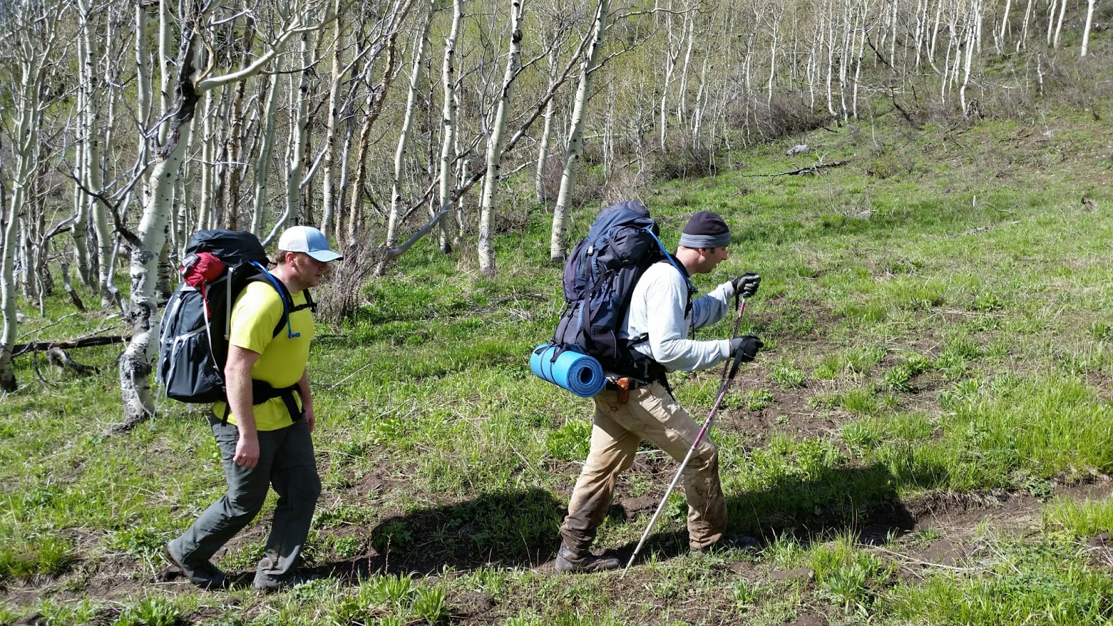
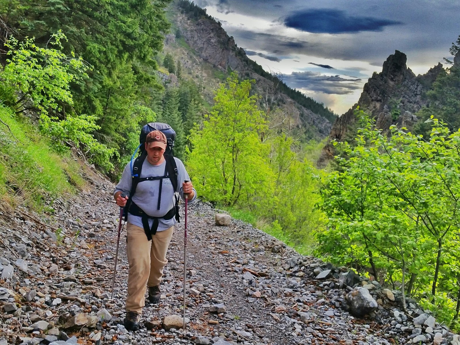
I absolutely love getting outside for little micro adventures! After a few changes in plans, Luke, Adam and I ended up backpacking up Slate Canyon to camp, and coming down Slide Canyon.


Our original plan for this weekend was to Backpack Nebo, but the weather was not playing nice. After some Caltopo map scouring, I tried to plan a route up Slate Canyon to loop around and come down Little Rock Canyon. however, once we got to the top where the trail was to take us over to Little Rock canyon, we quickly notices that we would be doing a lot of bushwhacking, since the trail was no longer present!


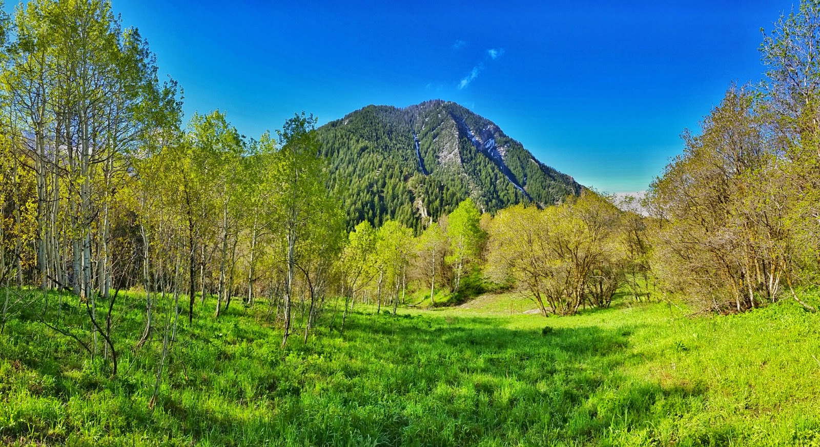
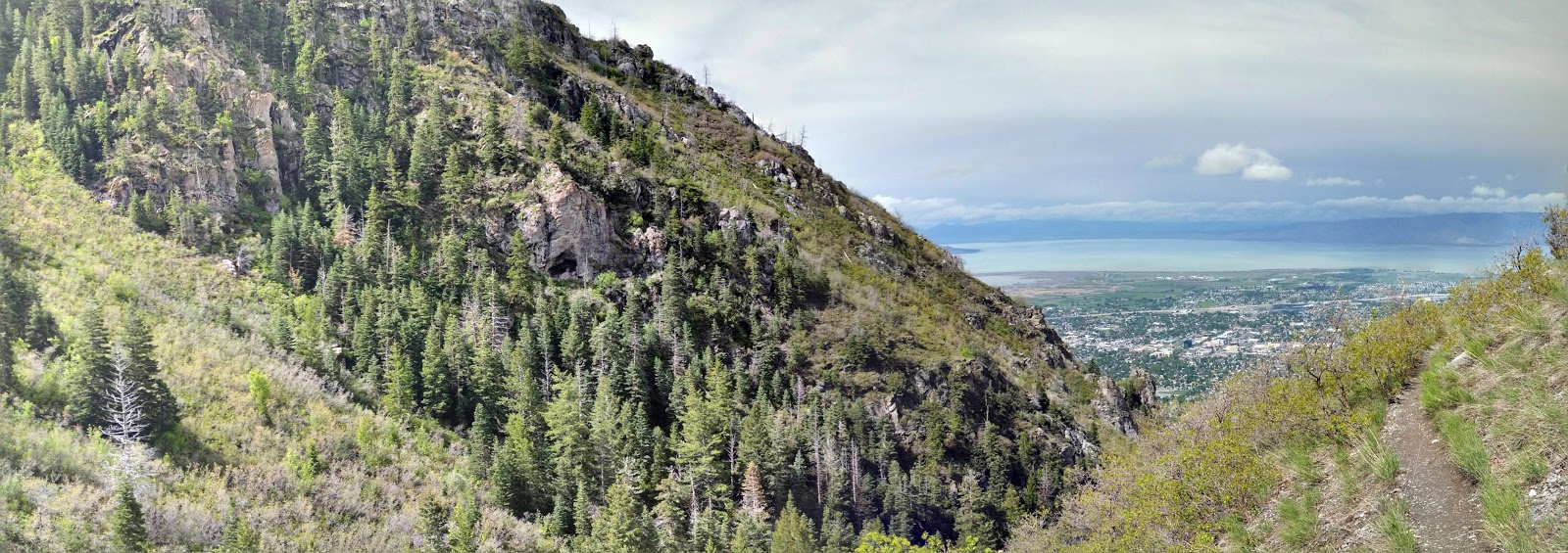
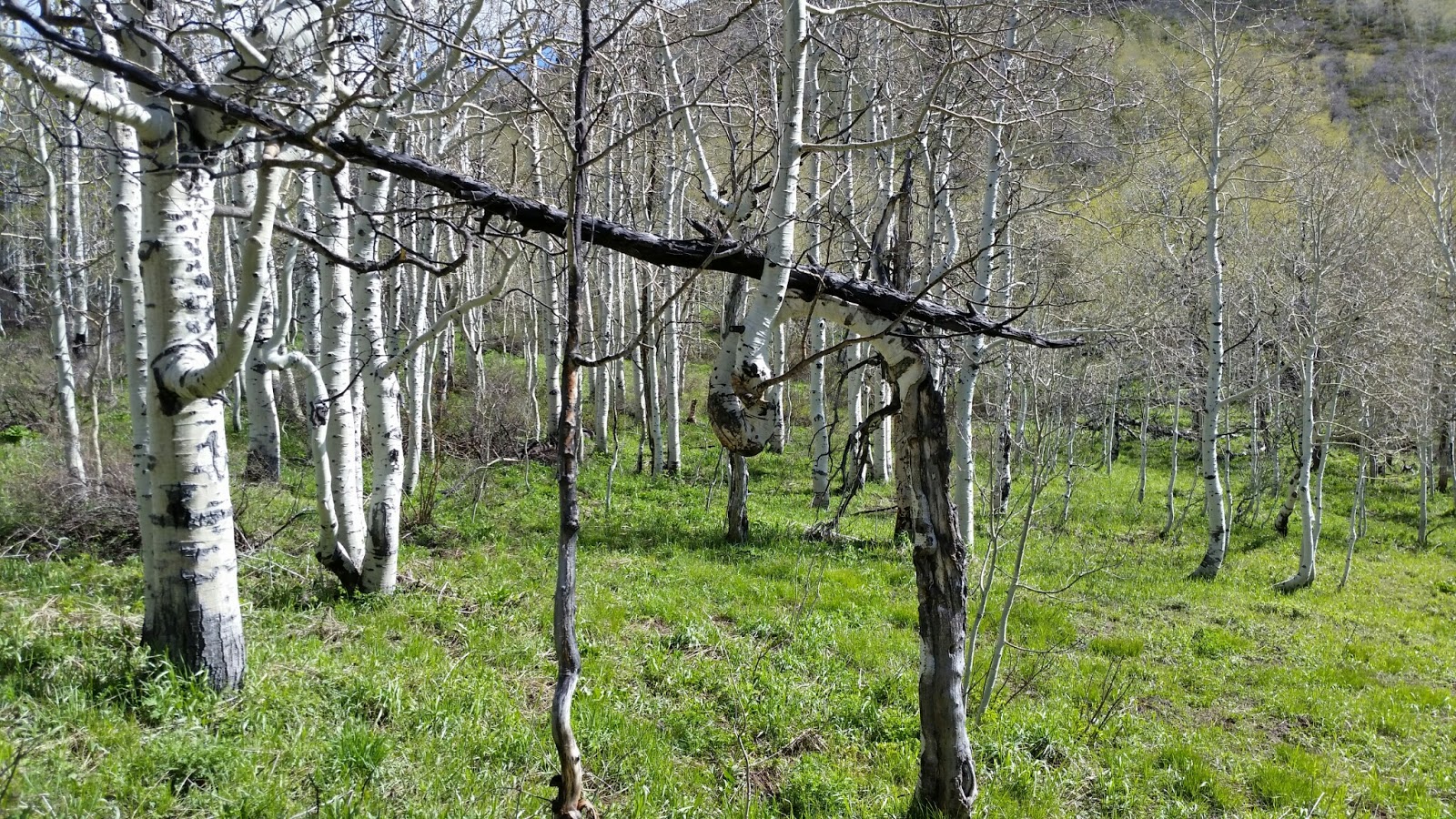
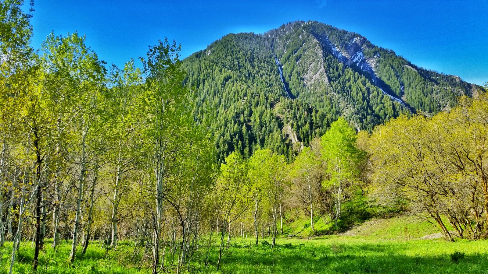
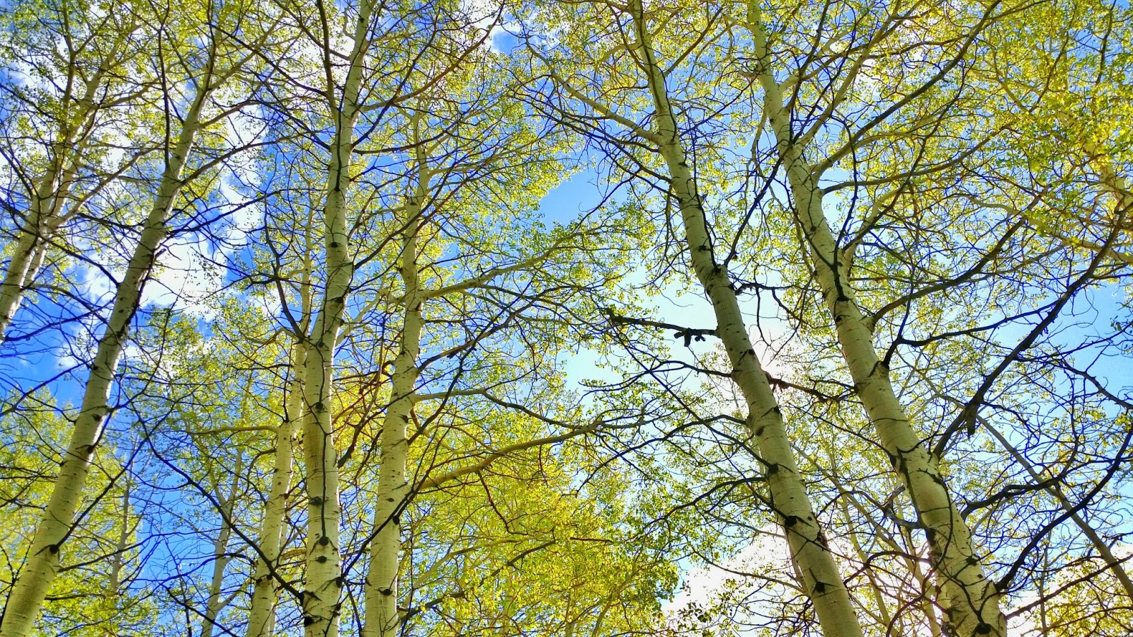
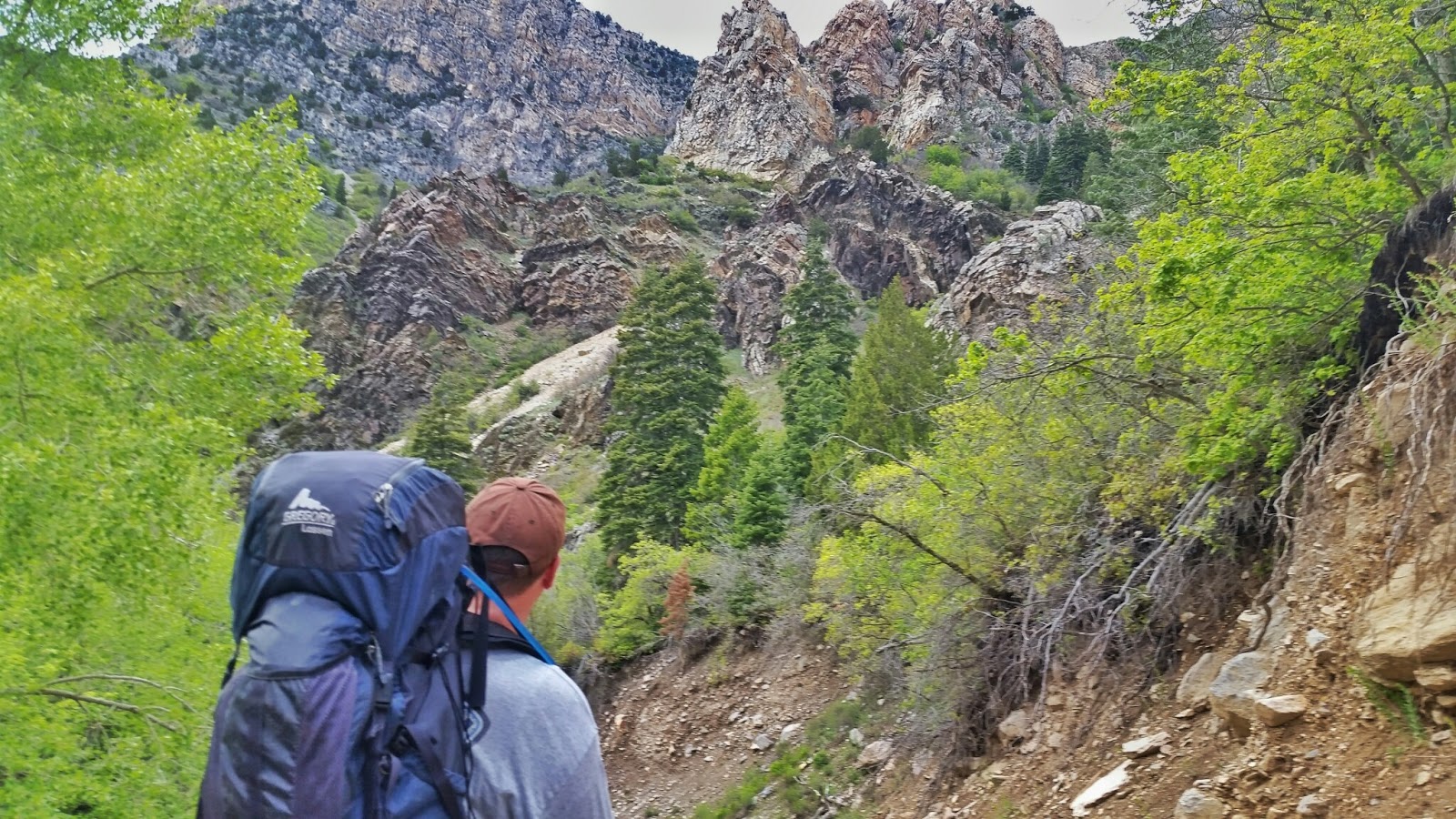
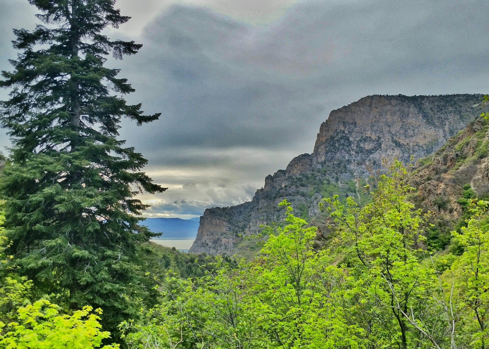
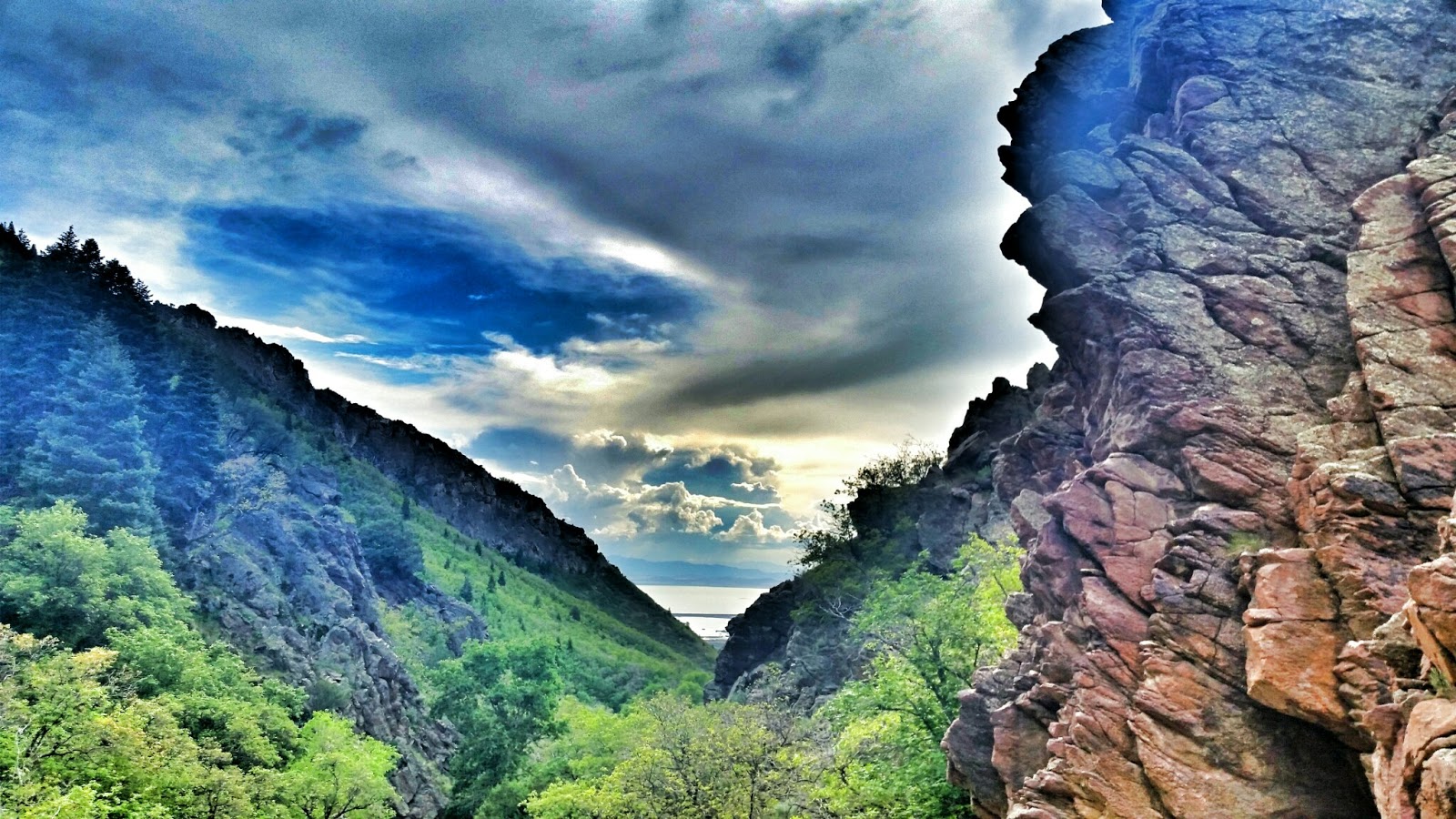
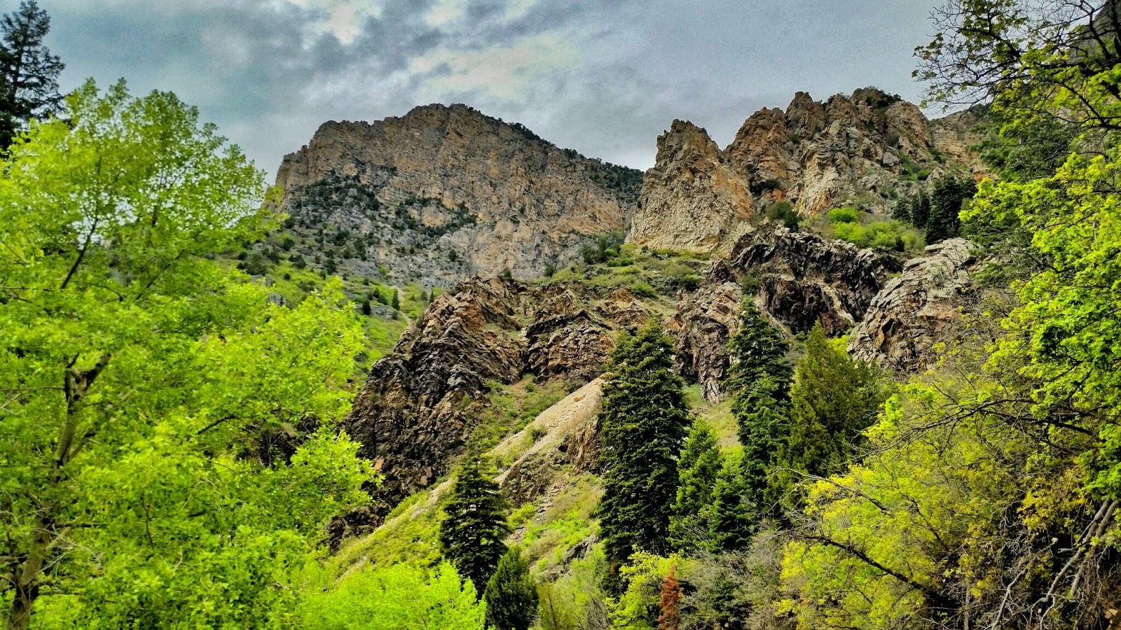
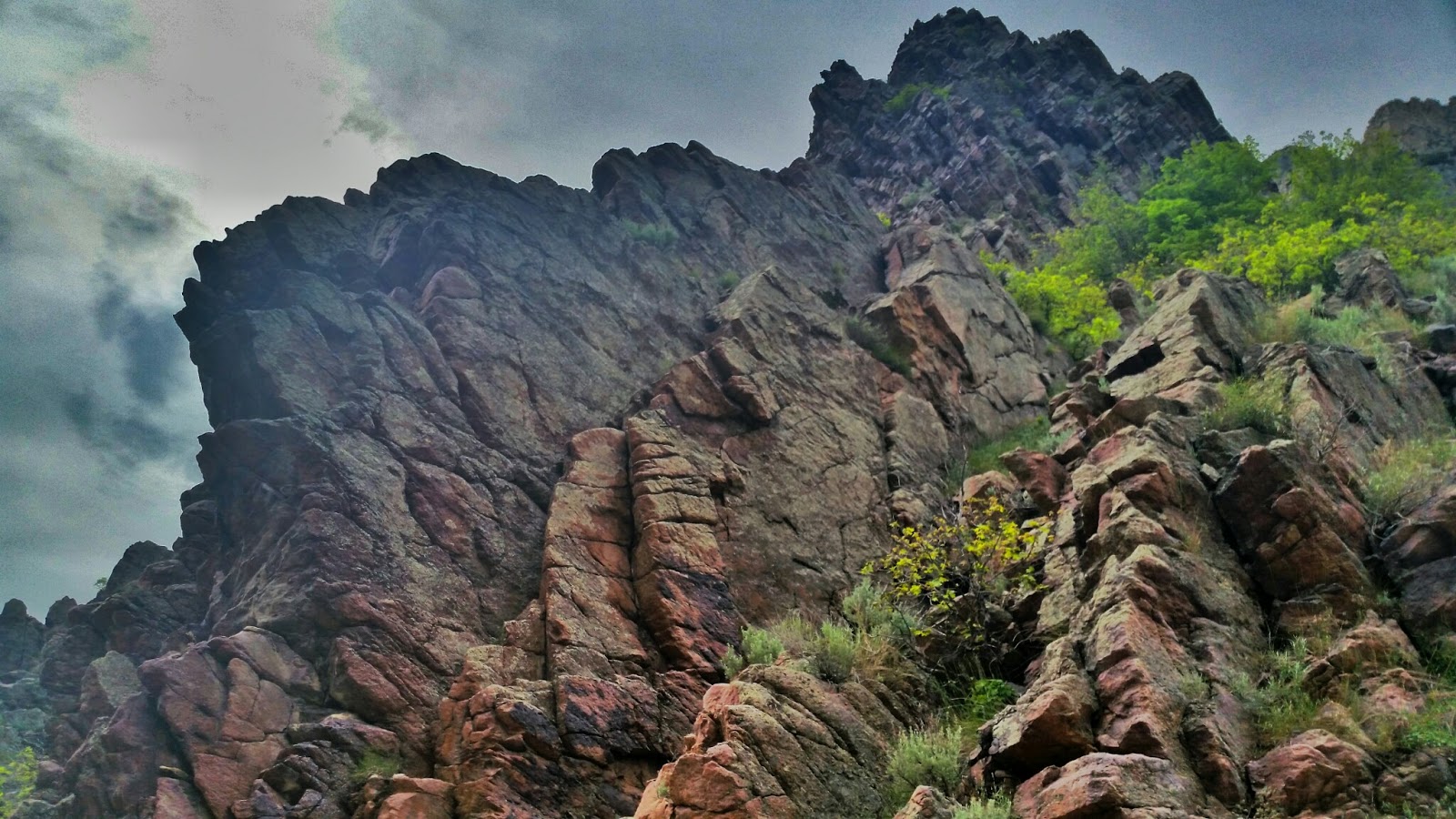
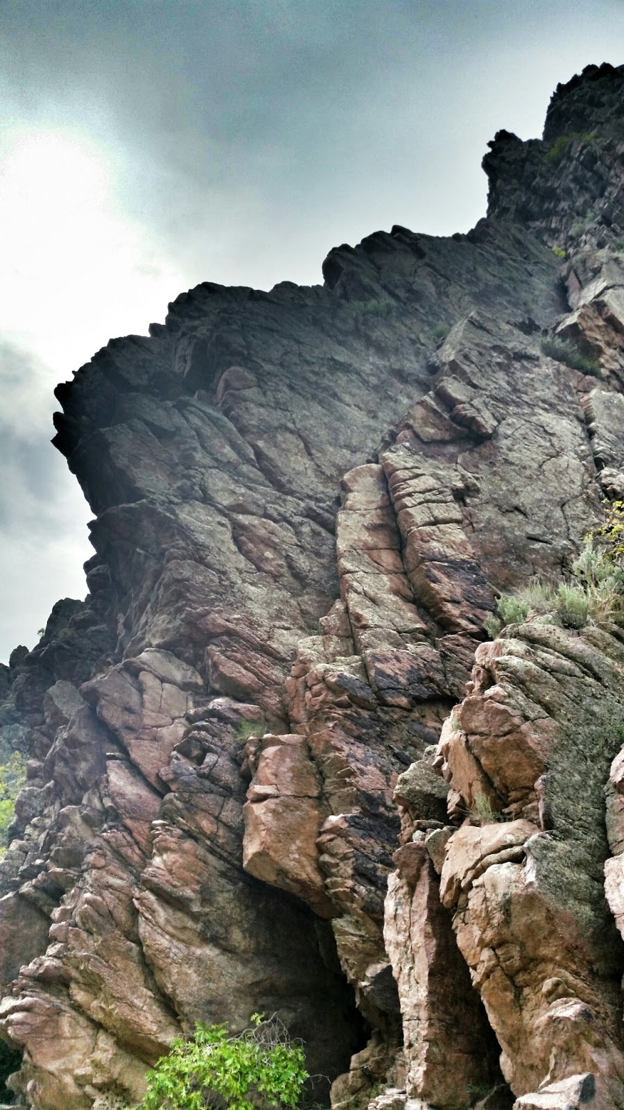
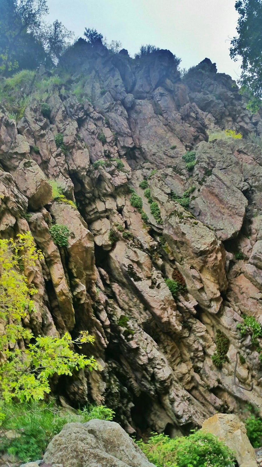
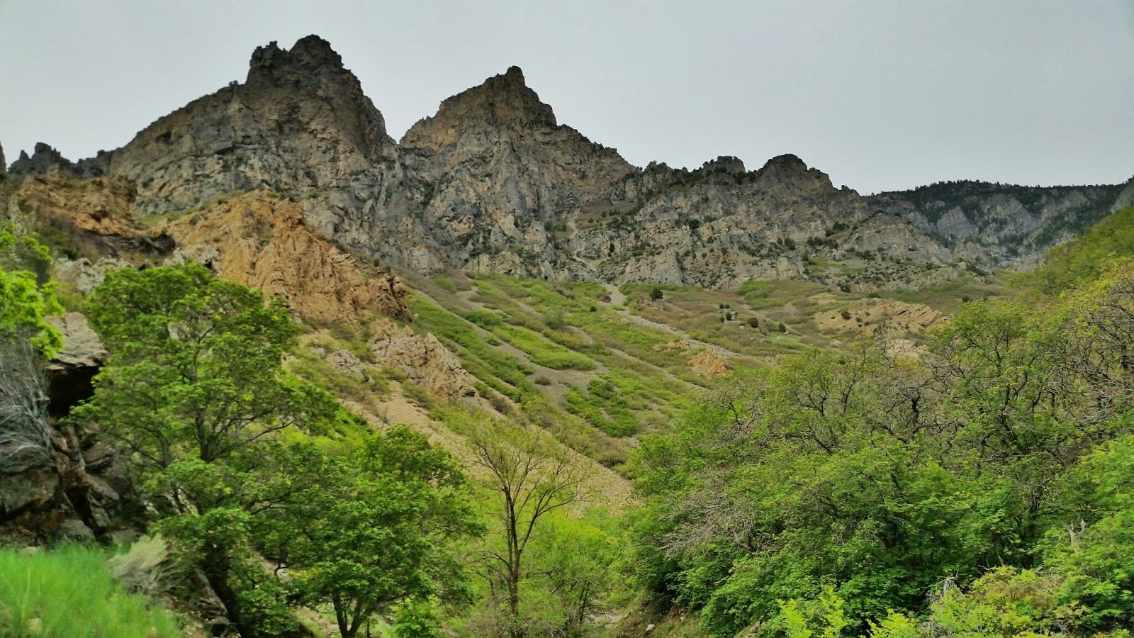
I was kinda bummed that we weren't able to make the loop over and down Little rock canyon, but that disappointment soon faded once we started our ascent up and over to Slide canyon. The views I saw from up there were gorgeous! The recent rainfall has turned the whole state of Utah green!


I am constantly amazed at the beauty to be found in the Wasatch mountains once you get up and into them. This trip was only about 10 miles round trip and we camped less than 2.5 miles (the way the crow flies) from the nearest house. The amazing thing to me is that even though were 2.5 miles away from Provo, I felt like I was deep in the backcountry of Utah. I found solitude, and it only took a few hours to get there!


If I may geek out a bit, below is the trail profile for our little trip. Kinda fun to hike 3900 feet in 4.5 miles! Amazing the beauty you will find in the high country :) I decided to leave my real GPS at home on this trip, and decided I wanted to track everything with my Phone and GPS app. I used a App called Backcountry Navigator Pro. This app allows me to download topos and satellite imagery so that I can see where I am on my phone when i'm out of cell range. I am pleased to say that my phone worked flawlessly! I can now accurately use my phone for GPS navigation and tracking, as well as note taking, movie watching, music listening, and picture taking and editing! Love it! Afterwords, I get to play with my data in CalTopo.com and geek out with stats!


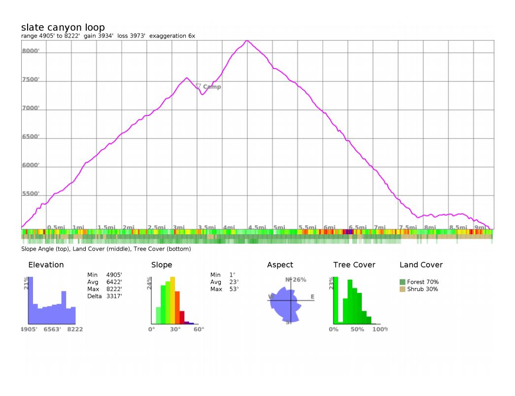
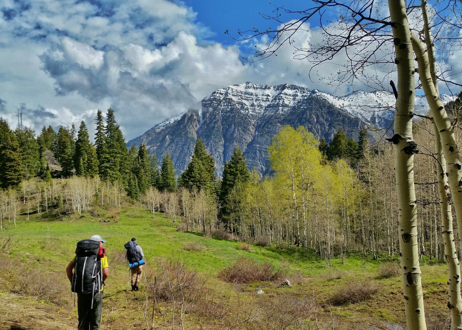
I had a great time hanging out with Luke and Adam. Both hadn't been backpacking for a while, so it was fun to get them out. Adam and I are preparing for a week long trip in the Wind Rivers this summer. Trips like this help us to get ready for that! Luke doesn't love backpacking, but he is a great friend and came with me anyway. I am so grateful for friends who are willing to come with me on these kind of trips.


The hike up was a doozy. We were all working pretty hard to make the climb, so when we got to camp we were ready for a break. After dinner was cooked and eaten, we all enjoyed a few games of Rook to entertain us for a hour or so. I had a blast chilling in the tent, laughing and playing games with friends. What a good time was had.


The weather that past couple weeks has been a bit wet. We thought for sure we would be slogging up the mountain in a rain storm, BUT it didn't pan out that way. We enjoyed cool temps for the hike up, and beautiful blue skies and puffy clouds on Saturday morning! I couldn't believe the weather was as good as it was. I blame Adam for rush shipping his pack rain cover. if he wouldn't have rush shipped that thing, i am pretty sure we would have been doomed to torrential rain showers the whole time! ;) 
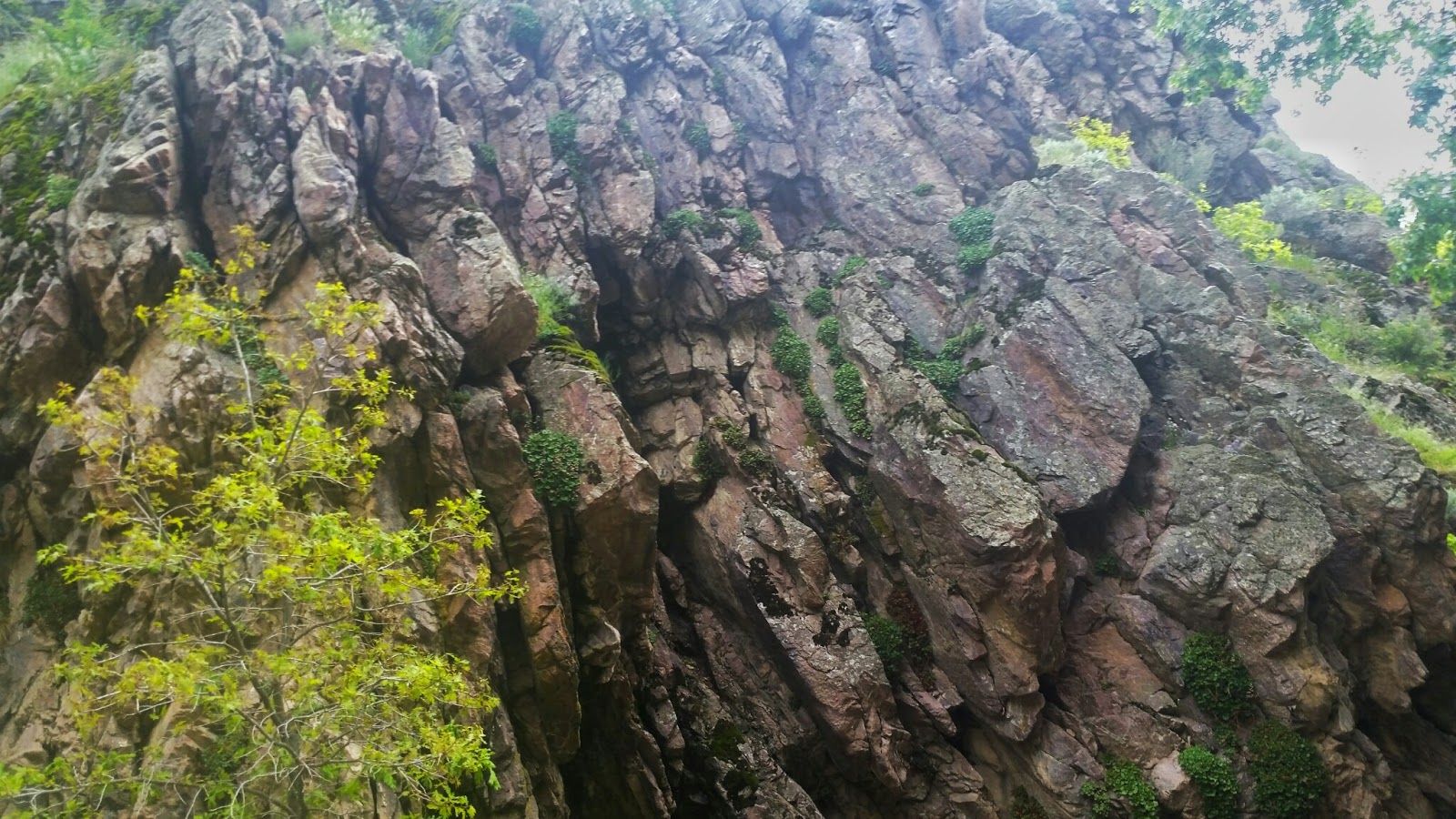
But.... we weren't, and the weather was perfect for us. We did get a bit of rain that night, but I was thrilled to test out my hammock in the rain. It had yet to sleep in my hammock in a storm, so I was hoping to get that experience on this trip. I was pleased with how dry I stayed in my little hammock :D


Now on to the good stuff! The area we hiked into was stunningly gorgeous. especially for being so close to home. Here are some pictures to prove it. enjoy!


Featured image for home page:
slide.jpg
 
Last edited:
Slate Canyon is literally out my front door and across the street. Where exactly did you all camp? I have some favorite spots along that route. Some good springs up Slate Canyon to capture water along the way too. I will be doing this in a month, but with plans to bag Provo Peak in the process too.
 
We originally tried to hike up and over to little Rock Canyon, and we got skunked...We would have had to bushwhack a ton to get over there, so we bailed and went back via Slide Canyon. We camped somewhere near the first main meadow passed the spring.
 
Little Rock or simply Rock Canyon? Little Rock would be quite a hike over as that is 2 canyons up from Slide with Rock Canyon in between (where all the rock climbers go). I started down that trail down to Rock Canyon from the top of Slide Canyon last year but turned around after seeing a fresh steaming pile of bear scat on the trail. It's definitely a trail not travelled much so I could see it being a good bushwhack further down.
 
Little Rock or simply Rock Canyon? Little Rock would be quite a hike over as that is 2 canyons up from Slide with Rock Canyon in between (where all the rock climbers go). I started down that trail down to Rock Canyon from the top of Slide Canyon last year but turned around after seeing a fresh steaming pile of bear scat on the trail. It's definitely a trail not travelled much so I could see it being a good bushwhack further down.
Little Rock Canyon in Springville. The one up from the McDonalds. At least that is what it is called on the map. looks like there are TWO canyons called Little Rock Canyon in the same wasatch mtn range.... how confusing!:confused:
 
Last edited:
Little Rock Canyon in Springville. The one up from the McDonalds. At least that is what it is called on the map. looks like there are TWO canyons called Little Rock Canyon in the same wasatch mtn range.... how confusing!:confused:

You are right! I never noticed that there was another little canyon by the same name south of Slate. How odd! That does make things confusing with two canyons named Little Rock Canyon coming off the same mountain like that. In the future, I guess we'll have to refer to them as Little Rock Canyon - North Provo and Little Rock Canyon - Springville or something.
 
Are there many good spots to camp up there?
 
Last edited:
Are there many good spots to camp near the top of Slate Canyon? Sounds like that's about where you set up.
SHHHHHH! there are some really awesome spots up at the top. We camped in a less-than-ideal spot, but we had a different agenda, and ended up switching things last minute.
 
SHHHHHH! there are some really awesome spots up at the top. We camped in a less-than-ideal spot, but we had a different agenda, and ended up switching things last minute.

Hahaha. I edited my previous comment to help maintain the ambiguity. Thanks! I've been up Slide to the turnoff for the Y Mountain summit and I've been up Slate just a little ways before. Connecting the two looks like it was a great overnighter. Great report and great pictures!

-Edit- I didn't realize it would still show up in your reply. I'm such a noob.
No worries! I was kidding (mostly) haha. That place really isn't very secret...

I really loved that little trip. so fun to get "away" even if it is only 2 miles from town. The scenery I saw back there was gorgeous. But it can be seen from the road above it even. It is just nice to get out camping. so fun!
 
@Blake Merrell , @Jackson, @WasatchWill :

Revisiting an old thread. My wife and I are looking to get out for a quick 1 nighter this month and we're looking at doing a loop with some sort of combination of Rock, Slide, and/or Slate Canyons.

Our original plan was to go up Rock Canyon, head south on the First Right Fork trail, connect with Slide Canyon, and head down. Do you guys know if this First Right Fork "goes"? My wife sees it in Gaia, but I don't see it on other maps. My guess is that it's old and rarely used and it would be a bushwhack. (Will, it seems like you've hiked on a portion of it when you did a loop up there and you mentioned it being old and unused).

I guess our backup plan will be the simpler Slide/Slate or Slate/Slide loop.

Also, if you guys have any beta on cool spots or water sources let me know. (PM if you want). It seems like most of those canyons pipe the water.

Thanks.
 
I've been up the Rock Canyon trail to the campground before, and we passed by the First Right Fork, but it was winter, so I couldn't see any trail. I'd definitely expect it to be brushy. Even the well traveled trails up around there can be quite jungle-like in places.

You could also hike to the campground, walk the road just a ways, then catch the trail that goes up over into Slide. As for water, I don't know of much in Rock Canyon and Slide Canyon. I've been to some springs in Slate Canyon, but that's it. It's also possible the creek in Slide is still running a bit (unless I'm mistaken and it's piped like Slate and Rock. Could have sworn I've heard water running in that canyon before), but that probably wouldn't last much longer.

Just don't start your trip by going up the Y trail. That's such an unpleasant trail with how steep, dusty, and sunbaked it is. Haha. I did my first overnighter ever on the Slate/Slide loop, and boy did I hate doing that with a full pack in the afternoon heat.

Will is an expert on that area, since he lives right there. I'm sure he'll have good info.

Thanks for sharing. Yeah, up Rock Canyon to the road would be an option. I hope you're right and there's still some flowing (in Slide). Haha...yeah...starting on the Y trail would be yuck in the afternoon heat. =)
 
Sure does look amazing! And what a steep incline. I would have been huffin' and puffin' the entire way! Thanks for sharing!
 
@Mike K - Pretty sure that First Right Fork still goes all the way through, and would actually offer up lots of shade. I think it still gets used by the occasional trail runner and horseback riders. Slate/Slide is still a good one. Good camping up in the meadow at the top of Slate just after the left fork (with a real nice bathtub spring) and also good camping at 'Apache Flat' (top of Slide where the First right fork out of Rock Canyon connects, also with a spring).

Another fun route to consider is going from Rock Canyon, taking the BST over and through the neighborhood up to Little Rock Canyon, then going up that, taking the left fork where you'll find water, then northward again until you reconnect with the BST, make your way up to Squaw Peak Overlook, then over toward Buffalo Peak, and then back down Rock Canyon. Alternatively, when up Little Rock Canyon, you can take a trail southward that will take you into that meadow between Squaw Peak and Buffalo Peak. Then close the loop back down Rock Canyon.
 
Back
Top