- Joined
- Jul 23, 2013
- Messages
- 1,657
Yesterday, I wanted to attempt a summit of Provo Peak via Slate Canyon right out my front door since a trailhead for Provo Peak exists right at the top of Slate Canyon. According to maps, there is no easy path leading right out of Slate and up to the Provo Peak parking area on Forest Road #27 above it. As we all know, not every trail is marked on maps, so I figured with Provo Peak parking area being so close, I'd surely find a path leading up to it. In fact, a neighbor of mine thought there was a dirt road the city used to reach some springs in the upper right fork of the basin. I was also keen to locate the springs along the way since I'd never seen them on previous hikes...so off I went...
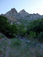
Morning light resting across the north side of the canyon.
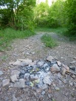
Fire ring right in the middle of the trail. Not cool!
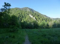
Meadow of the right fork near the top of Slate Canyon.
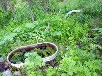
I found the the first springs. According to maps, it is named Boardman Spring.
I followed the trail a little further on, expecting to reach another spring known as Knight Spring and then expected to find myself on FR 27 shortly after that. Instead, shortly after Boardman Springs, I hit what appeared to be a dead end. The trail essential disappeared and I was facing a dangerously steep descent into a creek flowing below (presumably fed by Knight Spring) or a dense stretch of bushwhacking. Stymied and disappointed, I headed back down to the fork and decided to explore the left fork of Slate Canyon. I knew this trail would take me north to the top of Slide Canyon where I expected to find a more certain route leading up to FR 27.
Looking north at Cascade Mountain from the meadows atop Slide Canyon.
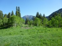
This was a pleasant meadow that even had a spring draining around its eastern side. Definitely going on my list of top local after-work overnight backpacking spots. "local after-work" = Reachable by foot from home in under 3 hours.
From the meadow I found a trail that descended into a gully through which the spring flowed into. I decided to follow hoping that it would soon lead to a fork that would head back up for the road. The trail descended rather steeply and became quite spooky with all the thick tree cover and other vegetation reaching over the trail. To add to the spookiness, I came across what I could only believe to be a fresh deposit of bear scat.
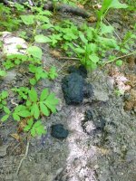
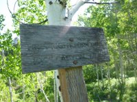
I paused for a moment, questioning with myself how much farther I was willing to press on. I decided to press on for a few more minutes and gave out some warning shouts in hopes of alarming anything that might be stirring nearby. I then reached a point where I realized the trail I was on was what is known as "first right fork" which connects with Rock Canyon about half way up Rock Canyon. It is an older and more desolate trail that may appear on older maps but does not appear on newer maps that I've seen. It was apparent that it receives very little human traffic. It was at this point that I gave up on finding a route up to FR 27 and ascended back up to meadow from which I came. Upon re-entering the meadow, I found this sign confirming the trail I had just come back up.
I took the opportunity to rest up in the meadow and review an older NG TI map of the area and realized I had somehow passed what should have been a trail leading up to FR27 from the middle of the pass between Slate and Slide canyons. This teaches one to study their map more carefully before setting off on a journey. Foiled, I decided it was getting too late to make a push back up for Provo Peak. It would have to wait for another day. Instead. I decided to finish off a loop of Slate to Slide Canyon. On the way down Slide, there is a turn off to ascend the top of Y Mountain and an overlook.
This is a view northward looking at Timp just before reaching the overlook...
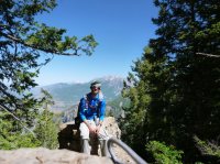
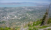
And view of the valley from the overlook itself.
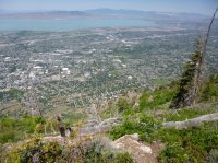
Looking back east, Provo Peak can be seen.
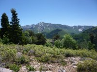
Panorama from Y Mountain overlook.

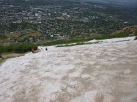
After exiting out of Slide Canyon, you find yourself at the the top of the Y. Doesn't look like much of a Y from this angle.
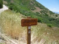
At the bottom of the Y trail there was a sign as if taunting me with: "FOREST RD. 27 4.5"
Here I took the BST back to Slate to finish out the loop and then back down into my neighborhood.
Note: I thought this would better fit as a "micro report" but now it appears longer than I expected so perhaps it can stand on its own under the "hiking" section if anyone feels it should be moved. I just don't think it's home page feature worthy.
Edit: So it looks like Nick was quick on the draw and voted it out as stand alone report, even worthy of the home page. I've now changed the photos to be full size.
Featured image for home page:
Morning light resting across the north side of the canyon.

Fire ring right in the middle of the trail. Not cool!

Meadow of the right fork near the top of Slate Canyon.

I found the the first springs. According to maps, it is named Boardman Spring.

I followed the trail a little further on, expecting to reach another spring known as Knight Spring and then expected to find myself on FR 27 shortly after that. Instead, shortly after Boardman Springs, I hit what appeared to be a dead end. The trail essential disappeared and I was facing a dangerously steep descent into a creek flowing below (presumably fed by Knight Spring) or a dense stretch of bushwhacking. Stymied and disappointed, I headed back down to the fork and decided to explore the left fork of Slate Canyon. I knew this trail would take me north to the top of Slide Canyon where I expected to find a more certain route leading up to FR 27.
Looking north at Cascade Mountain from the meadows atop Slide Canyon.

This was a pleasant meadow that even had a spring draining around its eastern side. Definitely going on my list of top local after-work overnight backpacking spots. "local after-work" = Reachable by foot from home in under 3 hours.
From the meadow I found a trail that descended into a gully through which the spring flowed into. I decided to follow hoping that it would soon lead to a fork that would head back up for the road. The trail descended rather steeply and became quite spooky with all the thick tree cover and other vegetation reaching over the trail. To add to the spookiness, I came across what I could only believe to be a fresh deposit of bear scat.

I paused for a moment, questioning with myself how much farther I was willing to press on. I decided to press on for a few more minutes and gave out some warning shouts in hopes of alarming anything that might be stirring nearby. I then reached a point where I realized the trail I was on was what is known as "first right fork" which connects with Rock Canyon about half way up Rock Canyon. It is an older and more desolate trail that may appear on older maps but does not appear on newer maps that I've seen. It was apparent that it receives very little human traffic. It was at this point that I gave up on finding a route up to FR 27 and ascended back up to meadow from which I came. Upon re-entering the meadow, I found this sign confirming the trail I had just come back up.

I took the opportunity to rest up in the meadow and review an older NG TI map of the area and realized I had somehow passed what should have been a trail leading up to FR27 from the middle of the pass between Slate and Slide canyons. This teaches one to study their map more carefully before setting off on a journey. Foiled, I decided it was getting too late to make a push back up for Provo Peak. It would have to wait for another day. Instead. I decided to finish off a loop of Slate to Slide Canyon. On the way down Slide, there is a turn off to ascend the top of Y Mountain and an overlook.
This is a view northward looking at Timp just before reaching the overlook...

And view of the valley from the overlook itself.

Looking back east, Provo Peak can be seen.

Panorama from Y Mountain overlook.
After exiting out of Slide Canyon, you find yourself at the the top of the Y. Doesn't look like much of a Y from this angle.

At the bottom of the Y trail there was a sign as if taunting me with: "FOREST RD. 27 4.5"

Here I took the BST back to Slate to finish out the loop and then back down into my neighborhood.
Note: I thought this would better fit as a "micro report" but now it appears longer than I expected so perhaps it can stand on its own under the "hiking" section if anyone feels it should be moved. I just don't think it's home page feature worthy.
Edit: So it looks like Nick was quick on the draw and voted it out as stand alone report, even worthy of the home page.
 I've now changed the photos to be full size.
Featured image for home page:

Last edited:
