Navigation
Install the app
How to install the app on iOS
Follow along with the video below to see how to install our site as a web app on your home screen.
Note: This feature may not be available in some browsers.
More options
You are using an out of date browser. It may not display this or other websites correctly.
You should upgrade or use an alternative browser.
You should upgrade or use an alternative browser.
The Maze
- Thread starter Aldaron
- Start date
Aldaron
Member
- Joined
- Jun 16, 2012
- Messages
- 1,487
Well, the first time I went out there the forecast called for rain, so I knew I didn't want to be on the switchbacks. The rain hit when we were a couple of hours away from Hite, and we were stuck in one place for 4 hours waiting for the road to get passable again. I was very glad we weren't stuck on the switchbacks during that. So after that I just kind of got it in my head that I like the Hite route better.
The Mineral Bottom switchbacks didn't bother me, so maybe the Flint switchbacks wouldn't, either.
The Mineral Bottom switchbacks didn't bother me, so maybe the Flint switchbacks wouldn't, either.
Midatlantic
Member
- Joined
- Feb 7, 2016
- Messages
- 12
Don't think this is an option for me, because I'll need to pick up the permit at Hans Flat ranger station. Another 4 miles or so from Happy Canyon camp ground doesn't sound nearly as bad as getting the Tacoma beached on the switchbacks.I've never had the nerve to brave the switchbacks...I have always gone in from Hite. It's a little longer, but not nearly as nerve-wracking.
Aldaron
Member
- Joined
- Jun 16, 2012
- Messages
- 1,487
They tell you that you have to pick up the permit in person, but both times I've overnighted out there, I called them ahead of time and asked if we could call in for our permit because we were coming in from Hite. Both times they said that would be okay. The first time I actually stopped at the pay phone in Hite and called to get the permit, and the second time I just called before we left Hanksville in the morning. I think the second time I called from Hanksville just in case they said no so that I could still head down to Hans Flat without backtracking. If you decide to try that, I would suggest calling ahead of time and confirming that will be okay...in other words, don't take my word for it!
IntrepidXJ
ADVENTR
- Joined
- Jan 17, 2012
- Messages
- 3,482
Since they went to the online permit system you no longer have to pick up your permit in person. They email it to you and you print it out yourself now. I haven't stopped at the Hans Flat Ranger Station in years!
They tell you that you have to pick up the permit in person, but both times I've overnighted out there, I called them ahead of time and asked if we could call in for our permit because we were coming in from Hite. Both times they said that would be okay. The first time I actually stopped at the pay phone in Hite and called to get the permit, and the second time I just called before we left Hanksville in the morning. I think the second time I called from Hanksville just in case they said no so that I could still head down to Hans Flat without backtracking. If you decide to try that, I would suggest calling ahead of time and confirming that will be okay...in other words, don't take my word for it!
IntrepidXJ
ADVENTR
- Joined
- Jan 17, 2012
- Messages
- 3,482
My last trip was two years ago...I can't remember if I got the actual permit online or not. Maybe they just say you have to stop by the ranger station on your way in, but they'll let you call in, also?
You don't need to call in either, anymore. Before the online system they required that you get the permit in person (or call in), but they don't do that anymore.
I'm looking at my Maze permit for May right now and nowhere on it does it say you need to stop in or call the ranger station. Just that you have to sign it to make it valid.
Midatlantic
Member
- Joined
- Feb 7, 2016
- Messages
- 12
Don't remember where I read that you had to pick up the permit in person, but actually looking at what they emailed and I've printed out, it is in fact the permit and dash tag. @IntrepidX is right - all you need to do is sign it.
All I have to do now is decide which route in to take - Hite or Hans Flat. I guess the only way to really make the decision about the switchbacks is to lay eyes on it, but thanks for all the advice.
All I have to do now is decide which route in to take - Hite or Hans Flat. I guess the only way to really make the decision about the switchbacks is to lay eyes on it, but thanks for all the advice.
regehr
Member
- Joined
- Mar 28, 2012
- Messages
- 2,251
Those rangers at Hans Flat must really get bored now. I've always wondered how exciting that job can be at certain times of the year.
Last summer I stopped by Hans Flat to give them an update since I'd driven some roads that hadn't had anyone on them since the last storms and the lady there did seem pretty bored!
regehr
Member
- Joined
- Mar 28, 2012
- Messages
- 2,251
As others are saying, unless the Flint Trail switchbacks are wet, snowy, or blown for some other reason you'd be absolutely fine there in a Tacoma. It's a pretty spectacular piece of road too.Don't think this is an option for me, because I'll need to pick up the permit at Hans Flat ranger station. Another 4 miles or so from Happy Canyon camp ground doesn't sound nearly as bad as getting the Tacoma beached on the switchbacks.
IntrepidXJ
ADVENTR
- Joined
- Jan 17, 2012
- Messages
- 3,482
The thing I like about the Flint Trail compared to some other steep and narrow switchbacks I have driven over the years is that typically the outer edge of the road it raised in most places, so even if it is a little slippery, it would be difficult to slide off the road.
IntrepidXJ
ADVENTR
- Joined
- Jan 17, 2012
- Messages
- 3,482
Don't remember where I read that you had to pick up the permit in person, but actually looking at what they emailed and I've printed out, it is in fact the permit and dash tag. @IntrepidX is right - all you need to do is sign it.
That used to be the policy before they went to the online system. I'm sure there are books, guides and websites out there that still have that outdated information in them which is probably where you came across it
- Joined
- Feb 23, 2012
- Messages
- 655
I'm looking at my Maze permit for May right now and nowhere on it does it say you need to stop in or call the ranger station. Just that you have to sign it to make it valid.
I wonder if this is the case for backcountry hiking permits now too. This message on the website makes me think it might be:
"Once your reservation is processed, you will receive an email with instructions for making a payment online. Once your payment is received, your permit will be sent by email."
That would be nice.
IntrepidXJ
ADVENTR
- Joined
- Jan 17, 2012
- Messages
- 3,482
I wonder if this is the case for backcountry hiking permits now too. This message on the website makes me think it might be:
"Once your reservation is processed, you will receive an email with instructions for making a payment online. Once your payment is received, your permit will be sent by email."
That would be nice.
It is. I've received backcountry hiking permits in Canyonlands, too.
slc_dan
Desert Rat-Weekend Warrior
- Joined
- Jun 7, 2012
- Messages
- 1,687
I wonder if this is the case for backcountry hiking permits now too. This message on the website makes me think it might be:
"Once your reservation is processed, you will receive an email with instructions for making a payment online. Once your payment is received, your permit will be sent by email."
That would be nice.
That's how I used my permits for salt creek in fall.
- Joined
- Feb 23, 2012
- Messages
- 655
It is. I've received backcountry hiking permits in Canyonlands, too.
That's great. Hopefully this means more thru-hikers will get legal permits instead of poaching or rushing through the park. It's so much better than the old system. I remember about 8 years ago I had to plead with the backcountry office to issue my permit 4 days early. While I was waiting, another party got denied their permit because the entire group of 6 wasn't present to listen to the rules and regulations!
Midatlantic
Member
- Joined
- Feb 7, 2016
- Messages
- 12
Thanks for the reassurances about the Flint switchbacks, which I'll maybe give a try in the Tacoma.
Back to the origin of this thread, Daniel Wesemann said he found information on 10 water sources in the Maze, including the Colorado at Spanish Bottom. So far I've only found mention of these seven sources, which do not include the Green and Colorado Rivers, so there could be two more. Anybody know of any others?
1 Maze Overlook 587728 4231674 -109.997680 38.228780
2 South Fork Horse Canyon 585137 4227271 -110.027807 38.189352
3 Lou's Spring (Ernie's Country) 582247 4221382 -110.061485 38.136553
4 Clell's Spring (Ernie's Country) 584481 4221031 -110.036037 38.133183
5 Water Canyon 593472 4228748 -109.932448 38.201835
6 Pictograph Fork 587167 4227286 -110.004627 38.189293
7 Pictograph Fork Confluence 588815 4231551 -109.985278 38.227565
- Joined
- Aug 9, 2007
- Messages
- 12,951
We found a really nice spring here: 38.200761,-109.996265. Could totally dry up but it was flowing well in May 2012.

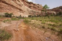
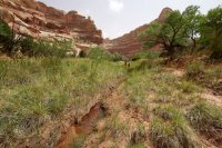
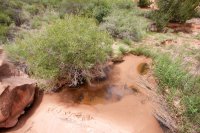
And there was a curious little puddle in the wash surrounded by a field of very out of place green grass, right around here: 38.198410,-109.999798. It was surrounded by animal prints. It was so small that I'm sure it would dry up quicker than most, but the presence of the grass makes me think it's not as ephemeral as the puddle made it look.

We walked past but not up to the one you list as #6 Pictograph Fork. There was a stagnant puddle at the base of a lush green area.


And there was a curious little puddle in the wash surrounded by a field of very out of place green grass, right around here: 38.198410,-109.999798. It was surrounded by animal prints. It was so small that I'm sure it would dry up quicker than most, but the presence of the grass makes me think it's not as ephemeral as the puddle made it look.

We walked past but not up to the one you list as #6 Pictograph Fork. There was a stagnant puddle at the base of a lush green area.

