Bob
Trailmaster
- Joined
- Mar 3, 2013
- Messages
- 4,306
Day 1 – Drove to Pinedale from Ogden so as to hit the trail early afternoon. Cloudburst rain from Kemmerer to Daniels Junction, not looking good. Headed to Green Lakes TH to drop a truck and it changed to partly sunny, yeah! Finally got to Elkhart about 2p, hit the trail about 230p. Heard rumors of snow and wind at the Outdoor shop. About photographers point changed to solid clouds and starting to rain, not good, still a ways we wanted to go. The big Peaks were socked in by BLACK clouds. Headed on out, light rain changed to a downpour..about 2 hours, however long it takes to get to Hobbs. Water running down the trail, nice mud and horse biscut soup in places (did I mention I hate horses on trails). Got to Hobbs Lk and the clouds broke some, rain quit…this is the place for camp as everyone was getting soaked.
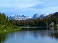
Day 2 – Awoke to mostly clear skies, excellent view across the lake to the high peaks from camp. Headed out, never saw anyone until Seneca Lk where there was one tent (everyone else left I guess). Passed three people from Jackson going up the divide from Little Seneca Lk. Then came the hordes… pack train, three or four groups heading out. Stayed fairly sunny until about the Indian trail jct. We decided not to head up that trail as the clouds were building and it was spitting rain. Made a short day and camped on the knoll just north of the Pothole lake out of sight. Never did rain till later that evening. We are getting killed on our daily mileage so far…
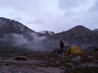
Day 3 – Decided to still go to the East side over Indian Pass. Awoke to clear morning (yeah!). Headed up the trail (sign says 6 miles but I’m not sure it’s that far). Halfway clouds are building again…..got to 11200 ft at the bottom of the steep up section to the pass and whammo…..wind, driving rain, clouds almost to the deck….we high tailed it back down to about 11000 ft, water running down the trail, off of rocks and getting pretty soaked and set camp on a flat spot right by the trail. Fastest I’ve ever set my rainbow tent up. Couple hours later 4 guys came by and knocked wanting to know if there were any camp sites higher up, said I didn’t know that this was the best we saw. They said they came over Knapsack Col in a thunderstorm and were headed for Big Sandy via Alpine lakes. Never saw them again. Someone else set two tents near us that evening but never saw where they went in the morning, I think down. Now we are a day behind our miles…….
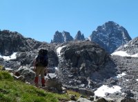
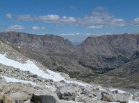
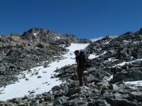
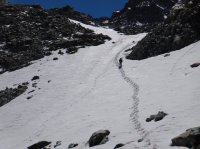
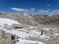
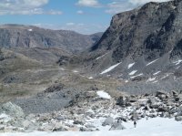
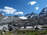
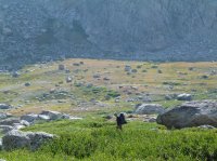
Day 4 – Sunny and blue. Headed back up to Indian Pass. Sucked wind up the steep section to 12200 ft. Way nice views both East and West. Cell service here. Discussed strategy. Our original plan was to cross East Indian Pass to the Dry Canyon area, but we were behind mileage wise. So we decided it may be easier to get back on track by heading for Glacier Point and cross Blaurock Pass into the Dinwoody instead. (Saving two days) We picked up the tracks from the guys the night before across Knifepoint Glacier and it looked like they made Alpine Pass. Going down the east side of Indian Pass is fairly rough. Heading down canyon east we found it’s best to stay as far north (left) as you can. There are some snowfields but plenty of rock patches to move down on but it gets steep the farther down you get. The very worst is the bottom on the rocky moraine. It is VERY slow going down this side, ate up a lot of time and was tiring. We hit the flats and finally camped down canyon a ways, but didn’t make it to Glacier Point like we wanted, too tired.
See PART 2 ..............................
Featured image for home page:

Day 2 – Awoke to mostly clear skies, excellent view across the lake to the high peaks from camp. Headed out, never saw anyone until Seneca Lk where there was one tent (everyone else left I guess). Passed three people from Jackson going up the divide from Little Seneca Lk. Then came the hordes… pack train, three or four groups heading out. Stayed fairly sunny until about the Indian trail jct. We decided not to head up that trail as the clouds were building and it was spitting rain. Made a short day and camped on the knoll just north of the Pothole lake out of sight. Never did rain till later that evening. We are getting killed on our daily mileage so far…

Day 3 – Decided to still go to the East side over Indian Pass. Awoke to clear morning (yeah!). Headed up the trail (sign says 6 miles but I’m not sure it’s that far). Halfway clouds are building again…..got to 11200 ft at the bottom of the steep up section to the pass and whammo…..wind, driving rain, clouds almost to the deck….we high tailed it back down to about 11000 ft, water running down the trail, off of rocks and getting pretty soaked and set camp on a flat spot right by the trail. Fastest I’ve ever set my rainbow tent up. Couple hours later 4 guys came by and knocked wanting to know if there were any camp sites higher up, said I didn’t know that this was the best we saw. They said they came over Knapsack Col in a thunderstorm and were headed for Big Sandy via Alpine lakes. Never saw them again. Someone else set two tents near us that evening but never saw where they went in the morning, I think down. Now we are a day behind our miles…….

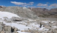
Day 4 – Sunny and blue. Headed back up to Indian Pass. Sucked wind up the steep section to 12200 ft. Way nice views both East and West. Cell service here. Discussed strategy. Our original plan was to cross East Indian Pass to the Dry Canyon area, but we were behind mileage wise. So we decided it may be easier to get back on track by heading for Glacier Point and cross Blaurock Pass into the Dinwoody instead. (Saving two days) We picked up the tracks from the guys the night before across Knifepoint Glacier and it looked like they made Alpine Pass. Going down the east side of Indian Pass is fairly rough. Heading down canyon east we found it’s best to stay as far north (left) as you can. There are some snowfields but plenty of rock patches to move down on but it gets steep the farther down you get. The very worst is the bottom on the rocky moraine. It is VERY slow going down this side, ate up a lot of time and was tiring. We hit the flats and finally camped down canyon a ways, but didn’t make it to Glacier Point like we wanted, too tired.


See PART 2 ..............................
Featured image for home page:

Last edited:

