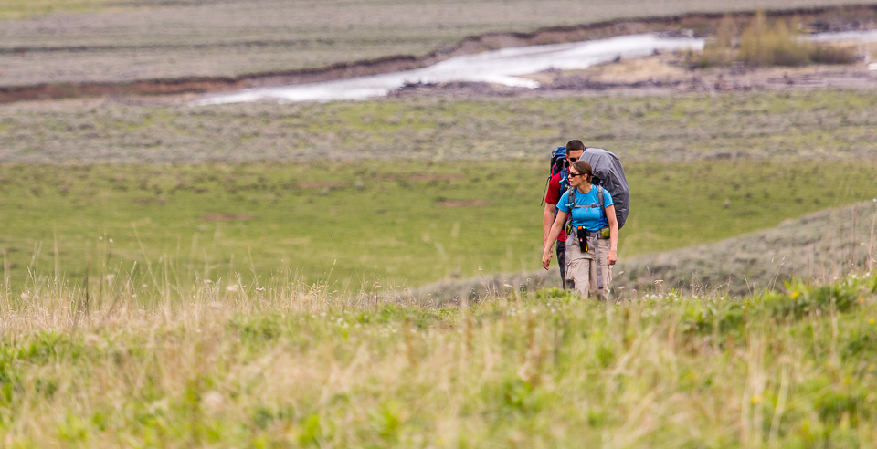
Joey
walking somewhere
- Joined
- Apr 1, 2014
- Messages
- 878
This is a 7 day backpack along the northern boundary of Yellowstone National Park. A large portion of the route is outside of the park, in Montana's Absaroka - Beartooth Wilderness. Joining me was @Bob . We start and end at Slough Creek. The route includes Slough, Buffalo, and Hellroaring Creek drainages, and the Buffalo Plateau. After the first 6 miles, we didn't see another person. We saw 6 bears, a family of badgers, elk, bison, coyotes, mule deer, sand hill cranes, and a rather large congregation of Marmots.
The route:
Click here to view on CalTopo
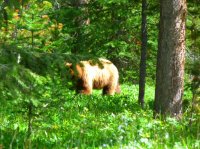
Day 1, June 13th, 2016: As usual, I intended to do a completely different route. Several of the backcountry campsites I wanted to use still weren't opened up, so thankfully I had this route on the back burner. Bob met me in West Yellowstone, and we headed off for the north east corner of the park. It was after 4pm when we finally arrived to the Slough Creek trail head. We had between 5 or 6 miles to hike to our first nights camp. Rain clouds threatened, but it never actually rained. We climbed up a small hill, passing a few dozen marmots (i'm not exaggerating) before dropping down into the first meadows along Slough Creek. Several bison were there, standing up, staring at us. We were so preoccupied with them that we almost didn't notice the bear right in front of us. It was hidden by a small rise along the trail, and we walked to within 40 feet of him. We backed off, and decided to divert to the edge of the creek, to by-pass both the bison and the bear. We sat for a good ten minutes watching this black bear, who didn't seem to care about us being there. The bison were more concerned with the bear than with us. Eventually the bear wandered up into the trees, and we continued up the creek, trying to make our way back to the trail. A pair of Sand Hill Cranes put on a show for us, trying to lead us away from their nest. They reminded me of a raptor in Jurassic Park, pacing through the high grass. Once back on trail, we had about 2 easy miles to our campsite. The views along the old wagon road trail here are some of the best in the park. The creek meanders through open meadows, and the Absaroka Mountains loom above in the distance. Our campsite was 2S2 along Hornaday Creek, which is tucked back in the trees away from the meadows. We set up our tents right next to the creek, and slept to the sound of rushing water the first night.

The first meadows along Slough Creek. Notice the bison in the distance. While the trail stays along the woods line to the right, we would end up walking the edge of the creek to avoid the bison.

Slough Creek


A few shots of the black bear.


Walking along Slough Creek to by pass the bison.

Bob about a mile from our campsite.


Images from our campsite. Not the best one out there, but the only one that was available that night.
Day 2: A few people passed us as we were breaking down camp in the morning. We would not see another person for the remainder of the trip. Right off the bat, we had an amazing encounter with a family of badgers. They were running down the trail towards us, and didn't notice us at first. Once they realized we were there, the mother and 2 of her cubs turned and ran into the sage brush. But one brave little guy just watched us. It was almost as if he wanted to ask us to play with him. The mother pushed the 2 cubs down into a den (I'm not sure if this was hers, or if she just made it work for the moment). The little guy was still out watching us. Mom came out and ushered him off the trail. He resisted going down into the den for as long as he could. Finally mom corralled him down, and they disappeared.

The family of badgers running toward us, still unaware of our presence.

Mom and the kids putting on the breaks. Probably my favorite shot, courtesy of Bob.

I lied. This is probably my favorite shot. I just picture this little guy in a kids voice saying "Hey, who are you guys? Will you play with me?"
Or maybe i'm completely wrong. He could be a bad ass little badger full of courage, ready to defend his mom and siblings.

Mom trying to get the last little one to go down into the den.

A close up shot.
The trail continues to be spectacular as it works its way north through large meadows. Deer and bison were out grazing. Within a few miles we reached a spur trail for backcountry campsite 2S4. A short distance later is the Elk Tongue Patrol Cabin, which sits along the edge of the third meadows at the junction with the Bliss Pass Trail. This area is sentimental to me for a few reasons. My first backpacking trip in Yellowstone was to this campsite. Over the years, I did several trips out to this site, usually using the front porch of the patrol cabin to cook dinner and breakfast. Over Memorial Day weekend in 2013 I was charged by what I believe to be a young grizzly bear along the shore of Slough Creek at the campsite. The bear continued to hang around camp, approaching my tent 4 times during the night before I finally abandoned my tent and walked over to the patrol cabin. Planning to climb onto the roof, I came across the outhouse and decided that would be a better spot to hole up in. The door doesn't latch from the inside, and has a natural swing in. I sat on that toilet bench with my back up against the wall, my feet propped up holding the door shut, with a can of bear spray in both hands. With in 20 minutes, the grizzly followed me over to the site. Through a sliver in the middle of the door panel I watched the shadow of the bear walk right in front of the outhouse. Thankfully, he never pushed on the door. The story goes on much more, but is for a different day, and has been described elsewhere. This was my first time coming back up to the patrol cabin since that event took place. Its a beautiful spot.


A few shots of Bob on the trail in the morning.

Me at the outhouse for the first time since taking refuge in it back in 2013.

Believe it or not, I was able to lay down on that bench and drift to sleep every now and again, before the bear would come back by. Being early in that year, it hadn't been used much, and didn't have any foul odor inside.


The view from the Elk Tongue Patrol Cabin's front porch.


Some retro photos from my first backpack in Yellowstone up Slough Creek with John Nause. We got snow in July on that trip.
We continued up Slough Creek for a few miles until we reached the park boundary with Montana's Absaroka Beartooth Wilderness. The meadows end, the mountains close in, and much of the area has been burned by fire. Silver Tip Ranch, a privately owned ranch, sits just outside the park. The trail changes form a wagon wheel road to a muddy mess of horse trails. Slough Creek itself goes through a section of white water, looking similar to Hellroaring Creek for a small distance. We dodged a few thunderstorms, and soon reached another forest service cabin. Its really open and full of sage brush in this area. We crossed Slough Creek, and made our way into Frenchy Meadows. This area is named after Joseph "Frenchy" Duret, who was a trapper living in the area back in the early 1900's. He was killed by a grizzly bear in 1922, and is buried somewhere in the meadows. You can read a well written report about Frenchy here: http://forums.yellowstone.net/viewtopic.php?f=4&t=7958 (You may have to search those YNET forums to find each of the 4 parts of the story). We spent a little while looking for his grave site, but never found it. Since we weren't originally planning on doing this trip, I didn't put any effort into where his grave site was located. We ended up finding an old corner of a log structure, along with some old farming equipment. There was quite a bit of old farming equipment and machinery scattered through out the large meadows. At the north end of the meadows, we decided to make camp. Right at dusk, 20 horses strolled out into the meadows. We hadn't seen any sign of humans, but there must have been an outfitters camp somewhere out there.


Images of Slough Creek near the park boundary.


The Silver Tip Ranch

The Slough Creek Forest Service Cabin.

Crossing Slough Creek, right before reaching Frenchy Meadows.


Frenchy Meadows

The corner of an old wooden structure, possibly a cabin.

Bob getting the attention of a buffalo.


Several of the old machinery/equipment that is scattered through out the meadows.


Views looking north (top) and south (bottom) along Bull Creek near our camp.


Camp at the northern end of Frenchy Meadows.
Day 3: After listening to tinker bells on the horses in the meadows the first part of the night, it started to rain on us at 3:15 am. It didn't stop raining until after 11 am. Kind of surprising to get that long of a storm with a forecast of no rain.") There was fresh snow on the top of the peaks. We were still socked in with weather, and weren't sure what the rest of the day would bring. We packed up our things wet, and started hiking up the Bull Creek drainage. The trail was hard to find at first, but soon was well established. We climbed up through re-growth forest, and had some great views behind us of the Absaroka peaks. Eventually, we were back in old growth, un-burned forest. The mosquitoes were terrible. It took forever to reach the top of the pass. Bull Creek Divide is at 8700 feet. While we were approaching the top, a large thunderstorm was passing to the south of us. I was not comfortable being up there. I ran across the top and waited a few minutes. After I could tell the main thunderstorm cell was past us, I ran back, and took better photos. Then more lightning and thunder started from the west side. Another storm was coming. Bob got to watch me run down into a more tree covered area. I don't trust lightning, especially up that high. It was kind of a bummer that we got bad weather up there, because Bull Creek Divide was one of the nicest spots along our route. There was still snow remaining, and some of it from earlier that day. With blue skies, the open alpine would have been beautiful. We worked our way down the west side, in and out of meadows that reminded me of the Sky Rim trail on the other side of the park. Soon we had a beautiful view of the Buffalo Creek Meadows below us. The trail drops down quickly at this point, with lots of switchbacks, as it makes its way down to Buffalo Creek. There is a forest service cabin here near the creek surrounded by small meadows. It is called the Buffalo Station, and was build in 1913. It was still raining on us, so we decided to stealth camp on the front porch to get dry. It ended up being great. It continued to rain off and on through out the night, but we stayed dry under the roof. We did get a good dry spell where we had a fire, and dried most of our stuff out.
There was fresh snow on the top of the peaks. We were still socked in with weather, and weren't sure what the rest of the day would bring. We packed up our things wet, and started hiking up the Bull Creek drainage. The trail was hard to find at first, but soon was well established. We climbed up through re-growth forest, and had some great views behind us of the Absaroka peaks. Eventually, we were back in old growth, un-burned forest. The mosquitoes were terrible. It took forever to reach the top of the pass. Bull Creek Divide is at 8700 feet. While we were approaching the top, a large thunderstorm was passing to the south of us. I was not comfortable being up there. I ran across the top and waited a few minutes. After I could tell the main thunderstorm cell was past us, I ran back, and took better photos. Then more lightning and thunder started from the west side. Another storm was coming. Bob got to watch me run down into a more tree covered area. I don't trust lightning, especially up that high. It was kind of a bummer that we got bad weather up there, because Bull Creek Divide was one of the nicest spots along our route. There was still snow remaining, and some of it from earlier that day. With blue skies, the open alpine would have been beautiful. We worked our way down the west side, in and out of meadows that reminded me of the Sky Rim trail on the other side of the park. Soon we had a beautiful view of the Buffalo Creek Meadows below us. The trail drops down quickly at this point, with lots of switchbacks, as it makes its way down to Buffalo Creek. There is a forest service cabin here near the creek surrounded by small meadows. It is called the Buffalo Station, and was build in 1913. It was still raining on us, so we decided to stealth camp on the front porch to get dry. It ended up being great. It continued to rain off and on through out the night, but we stayed dry under the roof. We did get a good dry spell where we had a fire, and dried most of our stuff out.


A view of the clouds socking us in while still at camp around noon.

Bob eats fruit cups instead of coffee in the morning.

Me packed up and ready to go. I often times have to pose for video or still photos. I like shots of myself when I don't know that they are being taken.

Heading up Bull Creek. The sun would pop out for a bit right after this, and lift our spirits.


As we climbed up the trail, we had good views behind us.

The Bull Creek drainage, and Slough Creek drainage in the distance.

Bob doing one of many log crossings.

There were a few nice small waterfalls as we approached the divide.

Almost to the top.


Bull Creek Divide, looking east.


Dropping down the west side to Buffalo Creek.

Buffalo Creek Meadows behind me. We had great views of the meadows for most of the hike down.

Bob and I crossing meadows towards the Buffalo Station Cabin.


A few images of our camp on the porch of the cabin.
Day 4: After some rain during the night, we woke up to sunshine We packed up camp and headed towards Telephone Basin. Right off the bat we had to ford Buffalo Creek. It wasn't difficult. The trail doesn't waste any time climbing up switchbacks. It was pretty open, and we had more great views. We got to the top of the plateau, then slowly climbed up through open alpine to reach Telephone Basin. It was a real pretty area. Wolf tracks and grizzly digs. Right at the end of the basin we climbed up switchbacks to reach the Hellroaring/Buffalo Divide, which is at 9,675 feet. The views were spectacular in every direction. We were hoping to eat lunch up there, but it was extremely windy. We followed the trail down into Elk Creek Basin. We must have been directly in the jet stream, and the wind just didn't let up. All the clouds were flying directly at us. Eventually we got down out of the wind, and took a break. The Elk Creek Basin area is pretty burnt up. Some of the ridges are 100% burned. It seemed to take us forever to hike down through it all. Eventually we were back in the forest, where the mosquitoes got thick. The trail was real muddy, and we could tell it gets a lot horse use.

Bob crossing Buffalo Creek in the morning.


The views as we climbed up to the top of the plateau.

Bob taking a break as the trail slowly levels off.


The view looking out at Telephone Basin as we climb up the last set of switchbacks to the divide.


The Hellroaring - Buffalo Divide sign, at elevation 9675 feet.

Bob and I at the divide, with a view to the east, north east behinds us.


Dropping down into Elk Creek Basin. Bull Mountain and Hellroaring Mountain are visible in the background.
We started to see lots of bear sign as we entered forest again. We popped out into a small meadow, and walked right into another black bear. We were way to close. The bear looked at us, then didn't seem to mind. We watched it for several minutes, when I suddenly noticed a smaller, blonde bear pop up from behind a knob. Even though it was only a black bear, sows with cubs are not something I want to be close to, and we were way too close. I yelled at Bob that she had a cub, and started backing up. As I made my way back, I heard Bob yell that she was coming towards us. I looked up to see the bear running out to where I had just been standing. She looked down on us for a few moments, then crashed off into the woods.
I've also kind of been wondering if we stumbled into 2 bears mating instead of a sow and cub. The 2nd bear I assumed was a cub was large for a black bear cub. It was almost as large as the first bear, which was decent size. I didn't take any photographs of the smaller blonde bear, and Bob never saw it. So I don't know for sure which it was.


We continued on down the trail. We started to encounter a lot more open meadows, along with swampy marsh area. Lots of small creek crossings. Looked like moose country (though we never saw one). We passed several trail junctions, including a few that aren't marked with signs. We basically followed the trail directly towards the Hellroaring Forest Service Cabin. Bob had his mind set on camping on another porch, but I wouldn't allow it. Near the junction of the Coyote Creek trail, we spooked a big grizzly. The biggest bear of the trip. He quickly crossed a meadow, then went up 100 feet of solid down fall with such finesse it was scary. We could see his muscles flexing as he took only a few seconds to climb something that would take me 30 minutes to navigate. Awesomeness! It happened so fast I wasn't able to take a picture of him. We continued on down the trail towards Hellroaring Creek, dropping steeply down a beautiful set of switchbacks. We finally reached the bridge, and crossed Hellroaring Creek. There is a nice campsite there, but its hard to access water. We went down the trail 10 minutes, and found a sweet campsite on a small meadow not to far from the creek. Bob continued to lobby for the forest service cabin, which he said was just around the corner. But I liked our spot. A food pole and fire ring already in place, we had a great, quiet, dry night.


Dropping down to Hellroaring Creek.

Lots of wildflowers


The upper bridge over Hellroaring Creek.

Another view of Hellroaring Creek.

Our tents on the edge of the meadow.

Bob filtering water as Hellroaring roars by.

Our campfire and meadow view. I guess Bob didn't hear me say I was taking a picture of us, and is probably wondering why I am standing in that pose facing the other way.
Day 5: This was our shortest day of the trip. We followed the Hellroaring trail south back into Yellowstone NP. It is very green and open in places. Back inside the park, the trail followed the creek much closer. A black bear walked along the opposite shore, and we were able to watch him for a good ten minutes. One point while I was filming he rubbed his butt on a tree multiple times. We crossed the lower Hellroaring Bridge, and then traveled off trail up the side of a ridge to reach the Coyote Creek trail. We followed that up about a mile to reach our campsite 2C1. I really didn't like this spot. The area above the camp is beautiful, with great views of Mount Washburn and the Yellowstone River valley. But the campsite itself sits down in a hole, with nothing to look at. The other side is bordered off by the creek and lots of downfall. Cut off from the wind, the mosquitoes were terrible. There is basically one place to set your tents up, and that isn't very far from the food prep area. If I were to do it again, I would camp up above the campsite, in the meadows. Or just stay at site 2C2, which is nicer.

Bob and myself in the morning in the meadows we camped in.

The remains of a big horn sheep.

Passing the Hellroaring forest service cabin, which sits in a large, beautiful meadow.

Looking down the Hellroaring Creek drainage. Mount Washburn is visible in the far distance.


Images of Hellroaring Creek as we hike down it.
 Bob patiently waiting on me to catch up.

A black bear on the other side of the creek.

A still taken out of video footage of the black bear rubbing hit butt.

Bob finally had to put his sun glasses on.

The lower Hellroaring Creek Bridge

The Coyote Creek Trail, about a mile from camp.


Views from backcountry campsite 2C1 and the hole it sits in.

Lots of elk sheds in the area.

A full moon.

Mount Washburn, as viewed from above the campsite. You can see the lookout at the top.
Day 6. We headed off trail right from camp. We climbed directly up the slopes east of camp, and made our way to the Buffalo Plateau trail. It was steep, but not very hard to figure out. We had spectacular open views behind us. Once we reached the trail, we continued to go up. It seemed like we went up forever. The views just got better. Most of the area is open, so the views last a long time. At the top of the plateau, we could see almost the entire park. Mount Sheridan was clearly visible, along with the Absarokas along the eastern boundary, and the Gallatins to the west. Glacier Lilys were everywhere. We followed the trail north back out of the park. As we dropped down towards Buffalo Creek, almost the entire area was burned. Not much has regrown. It was kind of eerie. We made it back down to the creek, and decided to set up camp there. Several elk were in the meadows. We battled mosquitoes the rest of the evening, and it was another quiet night, our last night of the trip.

Off trail hiking up to the Buffalo Plateau Trail.

A sand hill crane along the trail.

Near the top of the Buffalo Plateau, the Gallatin peaks visible in the distance.

The Buffalo Plateau Patrol Cabin.

Bob sitting in all the Glacier Lilys, enjoying the views from the park's northern boundary.


Views of the Buffalo Creek valley along the fire burned poacher's trail.


Camp night 6 along Buffalo Creek.
Day 7: Last day of the trip. About 8 miles back to Slough Creek. We had to ford Buffalo Creek right after leaving camp, and soon were back inside Yellowstone National Park. The trail doesn't follow along the creek, but stays up high. Lots of wildflowers, and great views. We started to notice a lot of fresh bear sign, both scat and tracks. We came across a second pile of scat, and it was so fresh that I told Bob "whatever pooped here is still here". About 100 yards later, we came across bear tracks in the mud that still had the ridges lines of the toes in the mud. We sat for a few minutes looking at them having a conversation, and then walked about 20 feet and saw a grizzly about 100 feet away. He was sitting in thimble berry bushes, eating the pods. We watched him for a good 10 minutes or more. He must have not known we were there, because all of a sudden he got up, and walked away. Maybe a minute later we could see him down by the creek, several hundred yards away. It was crazy to think he traveled that far that fast. We continued on down the trail, which gets prettier the closer we got to the end. We passed several anal bison before dropping down towards Slough Creek. We had great views of the meadows. As we closed in on the Slough Creek campground, Bob noted that we hadn't seen any boot tracks. He was hoping for a bridge across Slough Creek, but knew the lack of people meant no bridge. It was a tough crossing. The water was waste deep and flowing good. The large rocks on the bottom were super slick, and footing was hard. All the while battling the current. The first people we had seen in 6 days came out to watch us cross. But we made it. We walked the road back to my van to end the trip

Bob crossing Buffalo Creek in the morning, just before we entered back into Yellowstone.


Views along the Buffalo Creek Trail, just inside the Yellowstone Park Boundary.

Bob crossing another log.

fresh bear tracks in the mud. The bear was about 150 feet from this spot when we stopped here to look at the tracks.


several shots of the grizzly bear. All taken from video stills, which is why the quality is a little low.

The Slough Creek meadows below Bob as we near the end of the trail.


Bob crossing Slough Creek. He told me later he almost just jumped out and swam for it.

Me crossing Slough Creek. Bob took this photo with his phone. I wasn't quite to the deep part yet. I actually got quite nervous, because I had Bob's camera attached to my tripod, which I was using as a pole to cross with. All I cared about was not getting that camera wet. I have no idea why I didn't just put it in my pack before crossing.
Final thoughts: The wildlife viewing on this trip was just awesome. Slough Creek and Hellroaring Creek always have great wildlife since they are more open then other areas of the park. But it seemed like the whole trip we were stumbling into something. Not see people for 6 days, along with the constant river crossings, just made this trip feel like an adventure. I was impressed by both divides outside the park, and the meadows along Buffalo Creek. A lot less was burned than I had imagined. Frenchy Meadows was nice as well, although I wish I had taken some time to figure out a general idea of where the grave site was at.
Thanks again for reading. Joey
The route:
Click here to view on CalTopo
Day 1, June 13th, 2016: As usual, I intended to do a completely different route. Several of the backcountry campsites I wanted to use still weren't opened up, so thankfully I had this route on the back burner. Bob met me in West Yellowstone, and we headed off for the north east corner of the park. It was after 4pm when we finally arrived to the Slough Creek trail head. We had between 5 or 6 miles to hike to our first nights camp. Rain clouds threatened, but it never actually rained. We climbed up a small hill, passing a few dozen marmots (i'm not exaggerating) before dropping down into the first meadows along Slough Creek. Several bison were there, standing up, staring at us. We were so preoccupied with them that we almost didn't notice the bear right in front of us. It was hidden by a small rise along the trail, and we walked to within 40 feet of him. We backed off, and decided to divert to the edge of the creek, to by-pass both the bison and the bear. We sat for a good ten minutes watching this black bear, who didn't seem to care about us being there. The bison were more concerned with the bear than with us. Eventually the bear wandered up into the trees, and we continued up the creek, trying to make our way back to the trail. A pair of Sand Hill Cranes put on a show for us, trying to lead us away from their nest. They reminded me of a raptor in Jurassic Park, pacing through the high grass. Once back on trail, we had about 2 easy miles to our campsite. The views along the old wagon road trail here are some of the best in the park. The creek meanders through open meadows, and the Absaroka Mountains loom above in the distance. Our campsite was 2S2 along Hornaday Creek, which is tucked back in the trees away from the meadows. We set up our tents right next to the creek, and slept to the sound of rushing water the first night.
The first meadows along Slough Creek. Notice the bison in the distance. While the trail stays along the woods line to the right, we would end up walking the edge of the creek to avoid the bison.
Slough Creek
A few shots of the black bear.
Walking along Slough Creek to by pass the bison.
Bob about a mile from our campsite.
Images from our campsite. Not the best one out there, but the only one that was available that night.
Day 2: A few people passed us as we were breaking down camp in the morning. We would not see another person for the remainder of the trip. Right off the bat, we had an amazing encounter with a family of badgers. They were running down the trail towards us, and didn't notice us at first. Once they realized we were there, the mother and 2 of her cubs turned and ran into the sage brush. But one brave little guy just watched us. It was almost as if he wanted to ask us to play with him. The mother pushed the 2 cubs down into a den (I'm not sure if this was hers, or if she just made it work for the moment). The little guy was still out watching us. Mom came out and ushered him off the trail. He resisted going down into the den for as long as he could. Finally mom corralled him down, and they disappeared.
The family of badgers running toward us, still unaware of our presence.
Mom and the kids putting on the breaks. Probably my favorite shot, courtesy of Bob.
I lied. This is probably my favorite shot. I just picture this little guy in a kids voice saying "Hey, who are you guys? Will you play with me?"
Or maybe i'm completely wrong. He could be a bad ass little badger full of courage, ready to defend his mom and siblings.
Mom trying to get the last little one to go down into the den.
A close up shot.
The trail continues to be spectacular as it works its way north through large meadows. Deer and bison were out grazing. Within a few miles we reached a spur trail for backcountry campsite 2S4. A short distance later is the Elk Tongue Patrol Cabin, which sits along the edge of the third meadows at the junction with the Bliss Pass Trail. This area is sentimental to me for a few reasons. My first backpacking trip in Yellowstone was to this campsite. Over the years, I did several trips out to this site, usually using the front porch of the patrol cabin to cook dinner and breakfast. Over Memorial Day weekend in 2013 I was charged by what I believe to be a young grizzly bear along the shore of Slough Creek at the campsite. The bear continued to hang around camp, approaching my tent 4 times during the night before I finally abandoned my tent and walked over to the patrol cabin. Planning to climb onto the roof, I came across the outhouse and decided that would be a better spot to hole up in. The door doesn't latch from the inside, and has a natural swing in. I sat on that toilet bench with my back up against the wall, my feet propped up holding the door shut, with a can of bear spray in both hands. With in 20 minutes, the grizzly followed me over to the site. Through a sliver in the middle of the door panel I watched the shadow of the bear walk right in front of the outhouse. Thankfully, he never pushed on the door. The story goes on much more, but is for a different day, and has been described elsewhere. This was my first time coming back up to the patrol cabin since that event took place. Its a beautiful spot.
A few shots of Bob on the trail in the morning.
Me at the outhouse for the first time since taking refuge in it back in 2013.
Believe it or not, I was able to lay down on that bench and drift to sleep every now and again, before the bear would come back by. Being early in that year, it hadn't been used much, and didn't have any foul odor inside.
The view from the Elk Tongue Patrol Cabin's front porch.
Some retro photos from my first backpack in Yellowstone up Slough Creek with John Nause. We got snow in July on that trip.
We continued up Slough Creek for a few miles until we reached the park boundary with Montana's Absaroka Beartooth Wilderness. The meadows end, the mountains close in, and much of the area has been burned by fire. Silver Tip Ranch, a privately owned ranch, sits just outside the park. The trail changes form a wagon wheel road to a muddy mess of horse trails. Slough Creek itself goes through a section of white water, looking similar to Hellroaring Creek for a small distance. We dodged a few thunderstorms, and soon reached another forest service cabin. Its really open and full of sage brush in this area. We crossed Slough Creek, and made our way into Frenchy Meadows. This area is named after Joseph "Frenchy" Duret, who was a trapper living in the area back in the early 1900's. He was killed by a grizzly bear in 1922, and is buried somewhere in the meadows. You can read a well written report about Frenchy here: http://forums.yellowstone.net/viewtopic.php?f=4&t=7958 (You may have to search those YNET forums to find each of the 4 parts of the story). We spent a little while looking for his grave site, but never found it. Since we weren't originally planning on doing this trip, I didn't put any effort into where his grave site was located. We ended up finding an old corner of a log structure, along with some old farming equipment. There was quite a bit of old farming equipment and machinery scattered through out the large meadows. At the north end of the meadows, we decided to make camp. Right at dusk, 20 horses strolled out into the meadows. We hadn't seen any sign of humans, but there must have been an outfitters camp somewhere out there.
Images of Slough Creek near the park boundary.
The Silver Tip Ranch
The Slough Creek Forest Service Cabin.
Crossing Slough Creek, right before reaching Frenchy Meadows.
Frenchy Meadows
The corner of an old wooden structure, possibly a cabin.
Bob getting the attention of a buffalo.
Several of the old machinery/equipment that is scattered through out the meadows.
Views looking north (top) and south (bottom) along Bull Creek near our camp.
Camp at the northern end of Frenchy Meadows.
Day 3: After listening to tinker bells on the horses in the meadows the first part of the night, it started to rain on us at 3:15 am. It didn't stop raining until after 11 am. Kind of surprising to get that long of a storm with a forecast of no rain.
There was fresh snow on the top of the peaks. We were still socked in with weather, and weren't sure what the rest of the day would bring. We packed up our things wet, and started hiking up the Bull Creek drainage. The trail was hard to find at first, but soon was well established. We climbed up through re-growth forest, and had some great views behind us of the Absaroka peaks. Eventually, we were back in old growth, un-burned forest. The mosquitoes were terrible. It took forever to reach the top of the pass. Bull Creek Divide is at 8700 feet. While we were approaching the top, a large thunderstorm was passing to the south of us. I was not comfortable being up there. I ran across the top and waited a few minutes. After I could tell the main thunderstorm cell was past us, I ran back, and took better photos. Then more lightning and thunder started from the west side. Another storm was coming. Bob got to watch me run down into a more tree covered area. I don't trust lightning, especially up that high. It was kind of a bummer that we got bad weather up there, because Bull Creek Divide was one of the nicest spots along our route. There was still snow remaining, and some of it from earlier that day. With blue skies, the open alpine would have been beautiful. We worked our way down the west side, in and out of meadows that reminded me of the Sky Rim trail on the other side of the park. Soon we had a beautiful view of the Buffalo Creek Meadows below us. The trail drops down quickly at this point, with lots of switchbacks, as it makes its way down to Buffalo Creek. There is a forest service cabin here near the creek surrounded by small meadows. It is called the Buffalo Station, and was build in 1913. It was still raining on us, so we decided to stealth camp on the front porch to get dry. It ended up being great. It continued to rain off and on through out the night, but we stayed dry under the roof. We did get a good dry spell where we had a fire, and dried most of our stuff out. A view of the clouds socking us in while still at camp around noon.
Bob eats fruit cups instead of coffee in the morning.
Me packed up and ready to go. I often times have to pose for video or still photos. I like shots of myself when I don't know that they are being taken.
Heading up Bull Creek. The sun would pop out for a bit right after this, and lift our spirits.
As we climbed up the trail, we had good views behind us.
The Bull Creek drainage, and Slough Creek drainage in the distance.
Bob doing one of many log crossings.
There were a few nice small waterfalls as we approached the divide.
Almost to the top.
Bull Creek Divide, looking east.
Dropping down the west side to Buffalo Creek.
Buffalo Creek Meadows behind me. We had great views of the meadows for most of the hike down.
Bob and I crossing meadows towards the Buffalo Station Cabin.
A few images of our camp on the porch of the cabin.
Day 4: After some rain during the night, we woke up to sunshine We packed up camp and headed towards Telephone Basin. Right off the bat we had to ford Buffalo Creek. It wasn't difficult. The trail doesn't waste any time climbing up switchbacks. It was pretty open, and we had more great views. We got to the top of the plateau, then slowly climbed up through open alpine to reach Telephone Basin. It was a real pretty area. Wolf tracks and grizzly digs. Right at the end of the basin we climbed up switchbacks to reach the Hellroaring/Buffalo Divide, which is at 9,675 feet. The views were spectacular in every direction. We were hoping to eat lunch up there, but it was extremely windy. We followed the trail down into Elk Creek Basin. We must have been directly in the jet stream, and the wind just didn't let up. All the clouds were flying directly at us. Eventually we got down out of the wind, and took a break. The Elk Creek Basin area is pretty burnt up. Some of the ridges are 100% burned. It seemed to take us forever to hike down through it all. Eventually we were back in the forest, where the mosquitoes got thick. The trail was real muddy, and we could tell it gets a lot horse use.
Bob crossing Buffalo Creek in the morning.
The views as we climbed up to the top of the plateau.
Bob taking a break as the trail slowly levels off.
The view looking out at Telephone Basin as we climb up the last set of switchbacks to the divide.
The Hellroaring - Buffalo Divide sign, at elevation 9675 feet.
Bob and I at the divide, with a view to the east, north east behinds us.
Dropping down into Elk Creek Basin. Bull Mountain and Hellroaring Mountain are visible in the background.
We started to see lots of bear sign as we entered forest again. We popped out into a small meadow, and walked right into another black bear. We were way to close. The bear looked at us, then didn't seem to mind. We watched it for several minutes, when I suddenly noticed a smaller, blonde bear pop up from behind a knob. Even though it was only a black bear, sows with cubs are not something I want to be close to, and we were way too close. I yelled at Bob that she had a cub, and started backing up. As I made my way back, I heard Bob yell that she was coming towards us. I looked up to see the bear running out to where I had just been standing. She looked down on us for a few moments, then crashed off into the woods.
I've also kind of been wondering if we stumbled into 2 bears mating instead of a sow and cub. The 2nd bear I assumed was a cub was large for a black bear cub. It was almost as large as the first bear, which was decent size. I didn't take any photographs of the smaller blonde bear, and Bob never saw it. So I don't know for sure which it was.
We continued on down the trail. We started to encounter a lot more open meadows, along with swampy marsh area. Lots of small creek crossings. Looked like moose country (though we never saw one). We passed several trail junctions, including a few that aren't marked with signs. We basically followed the trail directly towards the Hellroaring Forest Service Cabin. Bob had his mind set on camping on another porch, but I wouldn't allow it. Near the junction of the Coyote Creek trail, we spooked a big grizzly. The biggest bear of the trip. He quickly crossed a meadow, then went up 100 feet of solid down fall with such finesse it was scary. We could see his muscles flexing as he took only a few seconds to climb something that would take me 30 minutes to navigate. Awesomeness! It happened so fast I wasn't able to take a picture of him. We continued on down the trail towards Hellroaring Creek, dropping steeply down a beautiful set of switchbacks. We finally reached the bridge, and crossed Hellroaring Creek. There is a nice campsite there, but its hard to access water. We went down the trail 10 minutes, and found a sweet campsite on a small meadow not to far from the creek. Bob continued to lobby for the forest service cabin, which he said was just around the corner. But I liked our spot. A food pole and fire ring already in place, we had a great, quiet, dry night.
Dropping down to Hellroaring Creek.
Lots of wildflowers
The upper bridge over Hellroaring Creek.
Another view of Hellroaring Creek.
Our tents on the edge of the meadow.
Bob filtering water as Hellroaring roars by.
Our campfire and meadow view. I guess Bob didn't hear me say I was taking a picture of us, and is probably wondering why I am standing in that pose facing the other way.
Day 5: This was our shortest day of the trip. We followed the Hellroaring trail south back into Yellowstone NP. It is very green and open in places. Back inside the park, the trail followed the creek much closer. A black bear walked along the opposite shore, and we were able to watch him for a good ten minutes. One point while I was filming he rubbed his butt on a tree multiple times. We crossed the lower Hellroaring Bridge, and then traveled off trail up the side of a ridge to reach the Coyote Creek trail. We followed that up about a mile to reach our campsite 2C1. I really didn't like this spot. The area above the camp is beautiful, with great views of Mount Washburn and the Yellowstone River valley. But the campsite itself sits down in a hole, with nothing to look at. The other side is bordered off by the creek and lots of downfall. Cut off from the wind, the mosquitoes were terrible. There is basically one place to set your tents up, and that isn't very far from the food prep area. If I were to do it again, I would camp up above the campsite, in the meadows. Or just stay at site 2C2, which is nicer.
Bob and myself in the morning in the meadows we camped in.
The remains of a big horn sheep.
Passing the Hellroaring forest service cabin, which sits in a large, beautiful meadow.
Looking down the Hellroaring Creek drainage. Mount Washburn is visible in the far distance.
Images of Hellroaring Creek as we hike down it.
Bob patiently waiting on me to catch up.A black bear on the other side of the creek.
A still taken out of video footage of the black bear rubbing hit butt.
Bob finally had to put his sun glasses on.
The lower Hellroaring Creek Bridge
The Coyote Creek Trail, about a mile from camp.
Views from backcountry campsite 2C1 and the hole it sits in.
Lots of elk sheds in the area.
A full moon.
Mount Washburn, as viewed from above the campsite. You can see the lookout at the top.
Day 6. We headed off trail right from camp. We climbed directly up the slopes east of camp, and made our way to the Buffalo Plateau trail. It was steep, but not very hard to figure out. We had spectacular open views behind us. Once we reached the trail, we continued to go up. It seemed like we went up forever. The views just got better. Most of the area is open, so the views last a long time. At the top of the plateau, we could see almost the entire park. Mount Sheridan was clearly visible, along with the Absarokas along the eastern boundary, and the Gallatins to the west. Glacier Lilys were everywhere. We followed the trail north back out of the park. As we dropped down towards Buffalo Creek, almost the entire area was burned. Not much has regrown. It was kind of eerie. We made it back down to the creek, and decided to set up camp there. Several elk were in the meadows. We battled mosquitoes the rest of the evening, and it was another quiet night, our last night of the trip.
Off trail hiking up to the Buffalo Plateau Trail.
A sand hill crane along the trail.
Near the top of the Buffalo Plateau, the Gallatin peaks visible in the distance.
The Buffalo Plateau Patrol Cabin.
Bob sitting in all the Glacier Lilys, enjoying the views from the park's northern boundary.
Views of the Buffalo Creek valley along the fire burned poacher's trail.
Camp night 6 along Buffalo Creek.
Day 7: Last day of the trip. About 8 miles back to Slough Creek. We had to ford Buffalo Creek right after leaving camp, and soon were back inside Yellowstone National Park. The trail doesn't follow along the creek, but stays up high. Lots of wildflowers, and great views. We started to notice a lot of fresh bear sign, both scat and tracks. We came across a second pile of scat, and it was so fresh that I told Bob "whatever pooped here is still here". About 100 yards later, we came across bear tracks in the mud that still had the ridges lines of the toes in the mud. We sat for a few minutes looking at them having a conversation, and then walked about 20 feet and saw a grizzly about 100 feet away. He was sitting in thimble berry bushes, eating the pods. We watched him for a good 10 minutes or more. He must have not known we were there, because all of a sudden he got up, and walked away. Maybe a minute later we could see him down by the creek, several hundred yards away. It was crazy to think he traveled that far that fast. We continued on down the trail, which gets prettier the closer we got to the end. We passed several anal bison before dropping down towards Slough Creek. We had great views of the meadows. As we closed in on the Slough Creek campground, Bob noted that we hadn't seen any boot tracks. He was hoping for a bridge across Slough Creek, but knew the lack of people meant no bridge. It was a tough crossing. The water was waste deep and flowing good. The large rocks on the bottom were super slick, and footing was hard. All the while battling the current. The first people we had seen in 6 days came out to watch us cross. But we made it. We walked the road back to my van to end the trip
Bob crossing Buffalo Creek in the morning, just before we entered back into Yellowstone.
Views along the Buffalo Creek Trail, just inside the Yellowstone Park Boundary.
Bob crossing another log.
fresh bear tracks in the mud. The bear was about 150 feet from this spot when we stopped here to look at the tracks.
several shots of the grizzly bear. All taken from video stills, which is why the quality is a little low.
The Slough Creek meadows below Bob as we near the end of the trail.
Bob crossing Slough Creek. He told me later he almost just jumped out and swam for it.
Me crossing Slough Creek. Bob took this photo with his phone. I wasn't quite to the deep part yet. I actually got quite nervous, because I had Bob's camera attached to my tripod, which I was using as a pole to cross with. All I cared about was not getting that camera wet. I have no idea why I didn't just put it in my pack before crossing.
Final thoughts: The wildlife viewing on this trip was just awesome. Slough Creek and Hellroaring Creek always have great wildlife since they are more open then other areas of the park. But it seemed like the whole trip we were stumbling into something. Not see people for 6 days, along with the constant river crossings, just made this trip feel like an adventure. I was impressed by both divides outside the park, and the meadows along Buffalo Creek. A lot less was burned than I had imagined. Frenchy Meadows was nice as well, although I wish I had taken some time to figure out a general idea of where the grave site was at.
Thanks again for reading. Joey
Attachments
Last edited: