HomerJ
Member
- Joined
- Jan 19, 2012
- Messages
- 1,199
We went in at the same trail head (Big Sandy) as we did last year, but we went past Big Sandy Lake to Clear Lake and camped above it. The trail is relatively easy going except for a few short steeper areas. The bad part is, is that we all thought we needed more food than we did and had close to 60 lbs packs! We sure did eat well though.
Day 1:
We left on Thursday around 7:15am and drove to Big Piney and bought our fishing licenses, bought lunch, and then continued on. The last part of the road is on dirt roads for about 45 mins. The road was a lot rougher than last year and I was glad I wasn't driving my car (drove it last year). We got to the trailhead and quickly ate our lunch and was off by 12:30. We finally made it to Clear lake and setup camp. Afterwards we ate then ran down to the lake and did some fishing before it got dark.
Day 2:
We hiked up the canyon we were at to Deep Lake and fished it most of the day.
Day 3:
We got up ate and headed out to hike into "The Cirque of the Towers" (about 4.5 miles from our camp). It's an extremely popular area for mountain climbers and I had missed seeing it last year. The trail is a really steep and rocky one, luckily we were a lot more acclimatized by now and could keep moving. I sure did pity those hikers with their big packs full of camping gear AND their climbing gear. The pity soon left me and I decided they were all insane for packing all that weight up and down such steep and rough terrain. Well, come to find out we missed where the trail switched back and went above the massive rocks and boulders. We saw some cairns out in the rocks and assumed it was the trail. Their must have been some boy scouts up there earlier putting the cairns up marking a trail through the boulders as a joke... and we fell for it!
Anyway, we made it to Jackass pass that looks down into "The Cirque" and decided there was no way we were going to hike down into the valley below and turn around and hike back up. We all were un-impressed with The Cirque! Maybe it's a lot prettier from Lonesome Lake, but from the pass it didn't live up to all the hype I had heard about it. That evening we caught a bunch of nice sized cutts for dinner. There's nothing like fresh fish!!!
Day 4:
It was cloudy and windy in the morning and soon started to rain. During a break in the weather we took off and headed to Rapid Lake. We fished Rapid Lake for a while (lots of small brookies), and the stream above it. On Rapid Lake it's more of a challenge to NOT catch a fish than to catch one. I'm sure you could through a bare hook out there and they'd take it! They are all really small fish though. Then we headed back to camp as the weather was moving in again. Luckily the weather went North and South of us and we only had to deal with the wind, which played havoc with the smoke from the fire as the direction kept changing requiring everyone to keep moving to avoid it.
Day 5:
It rained a little bit during the night and there was rain predicted for the day so we got up and quickly packed up our tents, sleeping gear, and clothes in case it decided to rain. We then ate breakfast, and headed out. We moved really fast and I had hot sore feet by the time we got to the truck. The weather was overcast and cool and was perfect for the hike out! We then drove to Big Piney, ate a greasy burger and was home by 5:30pm.
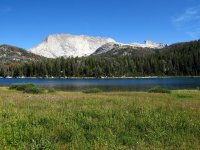
Big Sandy Lake - Haystack Mountain
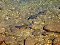
Brook Trout in Clear Lake
Deep Lake - East Temple Peak.
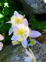
Columbine
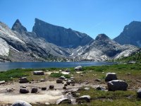
Deep Lake looking into "The Cirque"
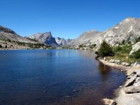
Deep Lake - East Temple Peak
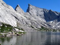
Clear Lake at sunset
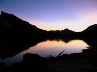
Clear Lake in the morning
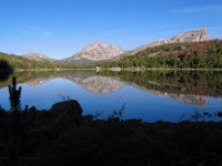
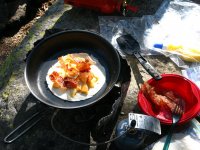
Cheese and bacon quesadillas! What a great breakfast!!! I think I actually gained weight on this trip!
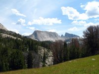
Haystack Mountain from trail to Jackass Pass
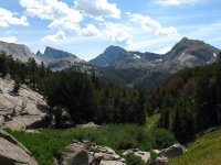
Looking south from trail to Jackass Pass
Arrowhead Lake
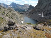
Pano of Cirque

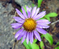
Above Clear Lake
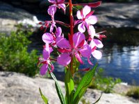
Above Clear Lake
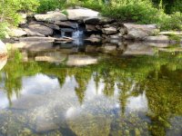
Above Clear Lake
Day 1:
We left on Thursday around 7:15am and drove to Big Piney and bought our fishing licenses, bought lunch, and then continued on. The last part of the road is on dirt roads for about 45 mins. The road was a lot rougher than last year and I was glad I wasn't driving my car (drove it last year). We got to the trailhead and quickly ate our lunch and was off by 12:30. We finally made it to Clear lake and setup camp. Afterwards we ate then ran down to the lake and did some fishing before it got dark.
Day 2:
We hiked up the canyon we were at to Deep Lake and fished it most of the day.
Day 3:
We got up ate and headed out to hike into "The Cirque of the Towers" (about 4.5 miles from our camp). It's an extremely popular area for mountain climbers and I had missed seeing it last year. The trail is a really steep and rocky one, luckily we were a lot more acclimatized by now and could keep moving. I sure did pity those hikers with their big packs full of camping gear AND their climbing gear. The pity soon left me and I decided they were all insane for packing all that weight up and down such steep and rough terrain. Well, come to find out we missed where the trail switched back and went above the massive rocks and boulders. We saw some cairns out in the rocks and assumed it was the trail. Their must have been some boy scouts up there earlier putting the cairns up marking a trail through the boulders as a joke... and we fell for it!
Anyway, we made it to Jackass pass that looks down into "The Cirque" and decided there was no way we were going to hike down into the valley below and turn around and hike back up. We all were un-impressed with The Cirque! Maybe it's a lot prettier from Lonesome Lake, but from the pass it didn't live up to all the hype I had heard about it. That evening we caught a bunch of nice sized cutts for dinner. There's nothing like fresh fish!!!
Day 4:
It was cloudy and windy in the morning and soon started to rain. During a break in the weather we took off and headed to Rapid Lake. We fished Rapid Lake for a while (lots of small brookies), and the stream above it. On Rapid Lake it's more of a challenge to NOT catch a fish than to catch one. I'm sure you could through a bare hook out there and they'd take it! They are all really small fish though. Then we headed back to camp as the weather was moving in again. Luckily the weather went North and South of us and we only had to deal with the wind, which played havoc with the smoke from the fire as the direction kept changing requiring everyone to keep moving to avoid it.
Day 5:
It rained a little bit during the night and there was rain predicted for the day so we got up and quickly packed up our tents, sleeping gear, and clothes in case it decided to rain. We then ate breakfast, and headed out. We moved really fast and I had hot sore feet by the time we got to the truck. The weather was overcast and cool and was perfect for the hike out! We then drove to Big Piney, ate a greasy burger and was home by 5:30pm.
Big Sandy Lake - Haystack Mountain

Brook Trout in Clear Lake

Deep Lake - East Temple Peak.

Columbine

Deep Lake looking into "The Cirque"

Deep Lake - East Temple Peak

Clear Lake at sunset

Clear Lake in the morning


Cheese and bacon quesadillas! What a great breakfast!!! I think I actually gained weight on this trip!

Haystack Mountain from trail to Jackass Pass

Looking south from trail to Jackass Pass

Arrowhead Lake

Pano of Cirque


Above Clear Lake

Above Clear Lake

Above Clear Lake

