Black Ridge Canyons Wilderness / Rattlesnake Canyon maps

Wanderlust073

Member
.
Joined
Oct 30, 2016
Messages
944
Does anyone happen to have the BLM maps for this area? I know I can pick them up in person, but I'm trying to do a little planning before a trip out there this weekend and the BLM website has been hosed all week so I can't download them and I can't seem to find them elsewhere on the web. I have the nat geo map for the area, but the BLM ranger I talked to said their trail maps had more detail about the actual trails.
 
Rattlesnake Canyon in particular, but I'm planning on getting to it from the Pollock Bench th.

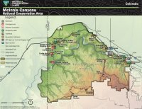
I managed to find the attached on the 'new' BLM website, but if it is what they hand out at the office I'm better of with the nat geo map and whatever I can put together on caltopo.

If you have something better I'd appreciate it!

blm.nca.map.jpg
 
Yeah I think you'll be fine. The only tricky thing is close to town where there are more trails it's handy to have the map that has the trail numbers (P1, F1, etc) but it's not bad. This site has a track on it and description. I thought I had an old map saved but can't find it. There is a sign to the arches at the point you leave the Pollock Bench trail.

Haven't been there recently but they also often have maps you can grab at the trailhead.

Edit: Here is the map with the trail numbers
 
Cool, that one with the trail #'s is very helpful.

Have you been down in rattlesnake canyon before? Seems like there is a lot of beta around pollock and the arches, but nothing I can find about rattlesnake canyon itself down to the river. Maybe it's as simple as 'walk between the walls till you see water', lol.
 
I haven't been in the bottom (you're on a bench pretty high above the canyon on the arches trail) and I can't remember if there's an "official" split or sign but there is a trail that splits off and goes to the bottom here. Both forks of Pollock are pretty cool in the upper ends as well.
 
I haven't been in the bottom (you're on a bench pretty high above the canyon on the arches trail) and I can't remember if there's an "official" split or sign but there is a trail that splits off and goes to the bottom here. Both forks of Pollock are pretty cool in the upper ends as well.

Nice. I found a route from the river back up to your IN marker on summitpost of all places, so I think I can string it together now. Thanks again!
 
Back
Top