JDWalters
Member
- Joined
- Apr 21, 2017
- Messages
- 120
I had a few days to spend in Utah last year. My wife and I had visited the previous year and my goal this time around was to visit spots that we hadn't been able to make it to.
First stop was Kanab, trying for a North Coyote Buttes permit. As usual, I was unsuccessful, but I drove to the Wire Pass trailhead anyway. We hadn't gotten to hike through Buckskin Gulch, and I also wanted to try to get up on West Clark Bench to do some exploring.
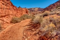
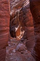
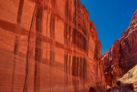
I made it through Wire Pass without any problems. I was planning to hike downstream in Buckskin Gulch, but found that there was quite a bit of water. I knew that this was a possibility, but had been hoping for a dry canyon, at least for a few miles. Turning around and going upstream also brought me to more pools. I pressed on through them, alternating between wet and dry areas. I figured that at least I could enjoy the canyon a bit and then try to climb out to West Clark Bench.
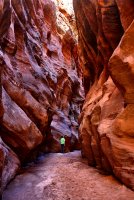
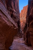
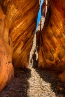
I didn't have to go too far before the canyon walls weren't so high and eventually I found a way out of the canyon.
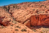
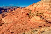
I began to explore the sandstone wonderland that lay around me.
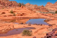
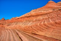
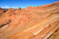
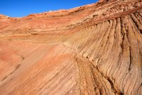
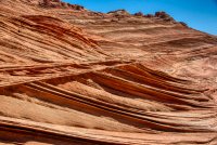
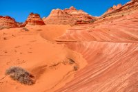
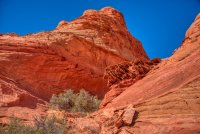
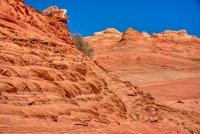
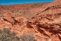
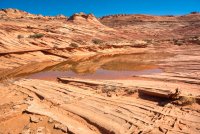
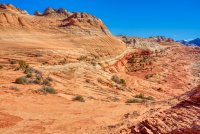
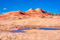
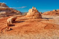
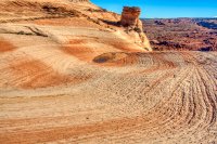
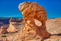
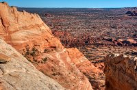
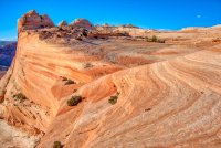
I would have loved to have more time to explore the area, but I didn't have much daylight left, so I began working my way north on the bench and then dropped back down to Buckskin Gulch.
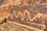
The next day, I drove through the San Rafael Reef area. I stopped by to see the Molen Reef petroglyphs.
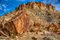
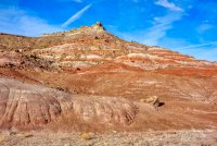
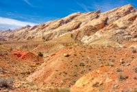
Then I headed east on Interstate 70, stopping at the various overlooks along the way. I live near the eastern end of I-70, and while it's not an ugly road around me, the scenery cannot compare to the San Rafael Swell area. Just gorgeous. This is a photo of the San Rafael Reef.
I had planned to hike in the Tidwell Draw area of the Swell, but found road conditions to be worse than I had hoped. I wasn't willing to take my rental 4WD over the roads that I came to, so I head south on UT-24 for Caineville.
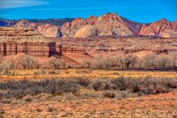
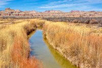

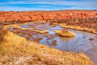
I stopped at the BLM station in Hanksville and asked about hiking up North Caineville Mesa. They told me where I needed to go to get through the North Caineville Reef and said that they had heard there was a way up the Mesa, although they had not done it themselves. I drove around North Caineville Mesa, past Factory Butte, looking for the pull-off area. The road was in great shape, although once I turned left to snake around the back of the Mesa, the road conditions deteriorated a bit. Still, I was able to get to the pull-off.
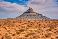
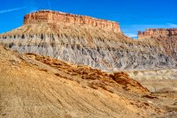
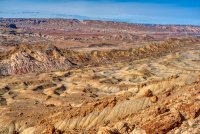
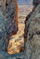
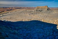
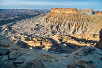
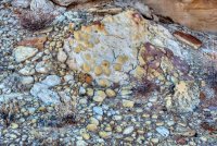
I found a notch through the top of North Caineville Mesa, and then wandered around the top. NCM is huge. I hiked several miles from the notch to where I could view Factory Butte, and still didn't touch the southern half of the mesa. I wish that I'd had more time -- and that I'd gotten there earlier; there were deep shadows around the base of the mesa by this point in the day.
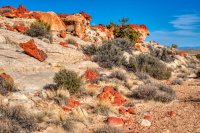
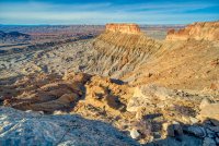
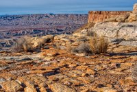
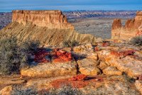
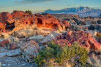
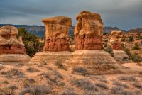
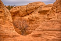
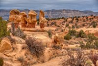
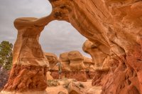
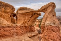
I stayed on top of the mesa until after sunset, then headed back down. Thankfully I was able to finish my descent before it got completely dark. The next morning, I drove down Hole in the Rock Road a little ways to the Devil's Garden. My goal for the day was to hike to Zebra Canyon, which had been flooded when my wife and I visited before. I didn't want to start hiking that too early, and Devil's Garden was something that we hadn't seen.
Next, I drove to the parking area for the trail to Zebra Canyon. Most of the trail was pretty straight-forward, but I was glad that I had my GPS for the end.
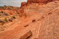
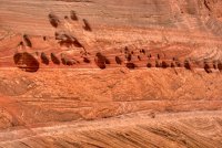
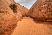
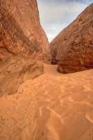
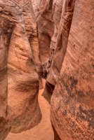
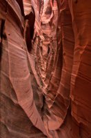
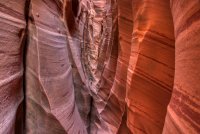
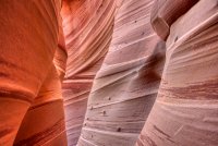
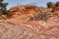
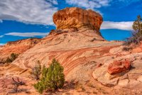
I was glad that I didn't begin my hike any later; there were a number of groups close to Zebra when I left, and I wouldn't want to have to get around others while in that tight space. I wandered around the area above the slot canyon, looking for moki marbles, but the GPS coordinates that I had were not accurate. There was some nice scenery though.
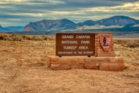
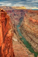
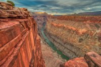
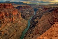
I didn't have a lot of time, but I wanted to see if I could make it to Toroweap Point on the way back to Las Vegas. I made it there about an hour before sunset.
I did quite a bit of driving during this trip, but in this part of the country, it was quite enjoyable. I had wonderful weather, and the car didn't break down or get a flat tire. I'm not sure when I'll be out this way again, but hopefully next time I'll have more than three days.
First stop was Kanab, trying for a North Coyote Buttes permit. As usual, I was unsuccessful, but I drove to the Wire Pass trailhead anyway. We hadn't gotten to hike through Buckskin Gulch, and I also wanted to try to get up on West Clark Bench to do some exploring.


I made it through Wire Pass without any problems. I was planning to hike downstream in Buckskin Gulch, but found that there was quite a bit of water. I knew that this was a possibility, but had been hoping for a dry canyon, at least for a few miles. Turning around and going upstream also brought me to more pools. I pressed on through them, alternating between wet and dry areas. I figured that at least I could enjoy the canyon a bit and then try to climb out to West Clark Bench.


I didn't have to go too far before the canyon walls weren't so high and eventually I found a way out of the canyon.

I began to explore the sandstone wonderland that lay around me.


I would have loved to have more time to explore the area, but I didn't have much daylight left, so I began working my way north on the bench and then dropped back down to Buckskin Gulch.

The next day, I drove through the San Rafael Reef area. I stopped by to see the Molen Reef petroglyphs.


Then I headed east on Interstate 70, stopping at the various overlooks along the way. I live near the eastern end of I-70, and while it's not an ugly road around me, the scenery cannot compare to the San Rafael Swell area. Just gorgeous. This is a photo of the San Rafael Reef.

I had planned to hike in the Tidwell Draw area of the Swell, but found road conditions to be worse than I had hoped. I wasn't willing to take my rental 4WD over the roads that I came to, so I head south on UT-24 for Caineville.


I stopped at the BLM station in Hanksville and asked about hiking up North Caineville Mesa. They told me where I needed to go to get through the North Caineville Reef and said that they had heard there was a way up the Mesa, although they had not done it themselves. I drove around North Caineville Mesa, past Factory Butte, looking for the pull-off area. The road was in great shape, although once I turned left to snake around the back of the Mesa, the road conditions deteriorated a bit. Still, I was able to get to the pull-off.


I found a notch through the top of North Caineville Mesa, and then wandered around the top. NCM is huge. I hiked several miles from the notch to where I could view Factory Butte, and still didn't touch the southern half of the mesa. I wish that I'd had more time -- and that I'd gotten there earlier; there were deep shadows around the base of the mesa by this point in the day.


I stayed on top of the mesa until after sunset, then headed back down. Thankfully I was able to finish my descent before it got completely dark. The next morning, I drove down Hole in the Rock Road a little ways to the Devil's Garden. My goal for the day was to hike to Zebra Canyon, which had been flooded when my wife and I visited before. I didn't want to start hiking that too early, and Devil's Garden was something that we hadn't seen.


Next, I drove to the parking area for the trail to Zebra Canyon. Most of the trail was pretty straight-forward, but I was glad that I had my GPS for the end.


I was glad that I didn't begin my hike any later; there were a number of groups close to Zebra when I left, and I wouldn't want to have to get around others while in that tight space. I wandered around the area above the slot canyon, looking for moki marbles, but the GPS coordinates that I had were not accurate. There was some nice scenery though.


I didn't have a lot of time, but I wanted to see if I could make it to Toroweap Point on the way back to Las Vegas. I made it there about an hour before sunset.


I did quite a bit of driving during this trip, but in this part of the country, it was quite enjoyable. I had wonderful weather, and the car didn't break down or get a flat tire. I'm not sure when I'll be out this way again, but hopefully next time I'll have more than three days.
Last edited:
